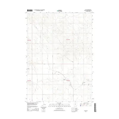
2015 Map of Allen
USGS Topo · Published 2015About this map
Allen serves as the central hub of this portion of Bennett County, situated at the intersection of Bia 9 and CR-10. The landscape is defined by the winding drainage of Bear-in-the-Lodge Cr to the southeast and the branching waters of Potato Cr and Corn Cr further north. Cultural history is etched into the terrain through several small burial grounds, including the Peyote Cem and Red Bear Cem located east of the main settlement. The survey detail highlights a network of rural routes such as Oglala Loop, Hackberry Dr, and Oak Rd, reflecting the sparse but enduring settlement patterns of the Pine Ridge region. These roads follow the natural contours of the hills, connecting remote homesteads and community sites across the high plains.
Find a feature on this map
29 named features on this map. Tap any name to fly to it.
Don’t see what you’re looking for? This feature index may not catch every label — zoom into the map to look around manually.
Map Details
Editions of this 2015 Allen Map
This is the sole edition of this map. No revisions or reprints were ever made.
Other maps of this area

1955 · Hot Springs
USGS Topo · 1:250,000

1955 · Martin
USGS Topo · 1:250,000

1958 · Martin
USGS Topo · 1:250,000

1981 · Yellow Bear Camp
USGS Topo · 1:25,000

1981 · Allen
USGS Topo · 1:25,000

1981 · Kyle
USGS Topo · 1:25,000
1981 · Batesland
USGS Topo · 1:25,000

1981 · Hisle
USGS Topo · 1:25,000

1981 · Swett
USGS Topo · 1:25,000

1983 · Martin
USGS Topo · 1:100,000