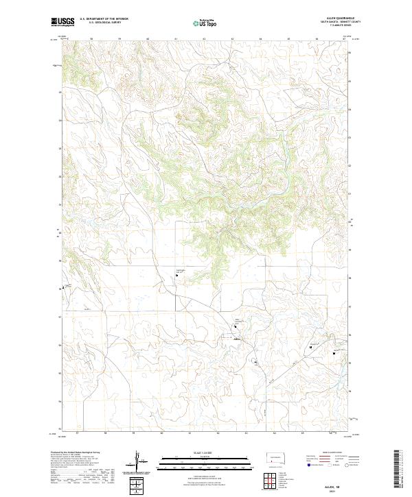
2021 Map of Allen
USGS Topo · Published 2021About this map
Allen serves as the central hub for this corner of Bennett County, where local life is centered around the intersection of Allen Rd and Bia RD 4. The landscape is defined by the winding paths of Corn Cr and Potato Cr, which carve through the high plains. A significant number of small, local cemeteries are scattered throughout the region, providing a rich field for genealogical research. Notable among these are the Allen Community Cem, Inestimable Gift Cem, and the uniquely named Peyote Cem. To the southeast, Bear-in-the-Lodge Cr flows toward the quadrant boundary near Red Bear Cem, illustrating a settlement pattern where communities and landmarks are deeply tied to the intermittent waterways of the South Dakota prairie.
Find a feature on this map
17 named features on this map. Tap any name to fly to it.
Don’t see what you’re looking for? This feature index may not catch every label — zoom into the map to look around manually.
Map Details
Editions of this 2021 Allen Map
This is the sole edition of this map. No revisions or reprints were ever made.
Other maps of this area

1955 · Hot Springs
USGS Topo · 1:250,000

1955 · Martin
USGS Topo · 1:250,000

1958 · Martin
USGS Topo · 1:250,000

1981 · Yellow Bear Camp
USGS Topo · 1:25,000

1981 · Allen
USGS Topo · 1:25,000

1981 · Kyle
USGS Topo · 1:25,000
1981 · Batesland
USGS Topo · 1:25,000

1981 · Hisle
USGS Topo · 1:25,000

1981 · Swett
USGS Topo · 1:25,000

1983 · Martin
USGS Topo · 1:100,000