1943 Map of Allendale
USGS Topo · Published 1943About this map
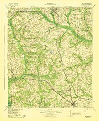
Salkehatchie River and Lower Three Runs define the hydraulic character of this South Carolina landscape, where early 20th-century agriculture and milling anchored the local economy. The network of milling sites, such as Chaney Grove Mill and Browns Mill, suggests a reliance on local waterpower that persisted even as rail transport expanded. Three major rail lines, including the Atlantic Coast Line and the Southern, intersect this territory, facilitating the growth of settlements like Barnwell and Allendale.
Find a feature on this map
54 named features on this map. Tap any name to fly to it.
Don’t see what you’re looking for? This feature index may not catch every label — zoom into the map to look around manually.
Map Details
Editions of this 1943 Allendale Map
This is the sole edition of this map. No revisions or reprints were ever made.
Other maps of this area

1918 · Varnville
USGS Topo · 1:62,500

1919 · Olar
USGS Topo · 1:62,500

1919 · Bamberg
USGS Topo · 1:48,000

1919 · Allendale
USGS Topo · 1:62,500

1920 · Ellenton
USGS Topo · 1:48,000

1920 · Hilltonia
USGS Topo · 1:62,500

1920 · Bamberg
USGS Topo · 1:62,500

1920 · Peeples
USGS Topo · 1:62,500

1920 · Talatha
USGS Topo · 1:48,000

1921 · Talatha
USGS Topo · 1:62,500