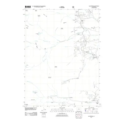
2011 Map of Allenspark
USGS Topo · Published 2011About this map
Saint Vrain Mountain and the high ridges of Wild Basin dominate this high-altitude landscape, where the headwaters of the North Saint Vrain Creek and Middle Saint Vrain Creek carve through the Front Range. The map captures a high-mountain economy transitioned from resource extraction to recreation, showing historic mining operations like the Twin Sister Mine, Majestic Mine, and Diana Mine alongside newer developments like the Rock Creek Ski Area. Small settlements such as Allenspark, Ferncliff, and Meeker Park cluster along the eastern edge, serving as gateways to the back-country. The distribution of numerous campgrounds, including Olive Ridge Campground and Meeker Park Campground, reflects the area's role as a major destination for early 21st-century outdoor enthusiasts. Water management remains central to the geography, evidenced by features like the Pear Dam and Green Lake Dam.
Find a feature on this map
79 named features on this map. Tap any name to fly to it.
Don’t see what you’re looking for? This feature index may not catch every label — zoom into the map to look around manually.
Map Details
Editions of this 2011 Allenspark Map
This is the sole edition of this map. No revisions or reprints were ever made.
Other maps of this area

1902 · Boulder
USGS Topo · 1:62,500

1904 · Boulder
USGS Topo · 1:62,500

1905 · Mount Olympus
USGS Topo · 1:62,500

1907 · Mount Olympus
USGS Topo · 1:62,500

1915 · Longs Peak
USGS Topo · 1:125,000

1919 · Rocky Mountain National Park
USGS Topo · 1:125,000

1954 · Greeley
USGS Topo · 1:250,000

1957 · Greeley
USGS Topo · 1:250,000

1957 · Mc Henrys Peak
USGS Topo · 1:24,000

1957 · Allens Park
USGS Topo · 1:24,000