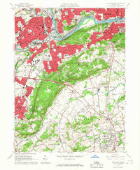
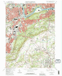
1964 Map of Allentown East
USGS Topo · Published 1967About this map
The Lehigh River corridor defines this industrial and residential landscape during the mid-1960s, serving as a conduit for the Lehigh Valley RR and the Central RR of New Jersey. The urban cores of Allentown and Bethlehem expand toward one another through neighborhoods like Ritterville and Hanover Acres, while the legacy of the Lehigh Canal remains visible along the riverbanks. Highlighting the region's educational and religious infrastructure are St Francis de Sales College and the Carmelite Monastery, alongside numerous schools such as Dieruff High Sch.
Find a feature on this map
94 named features on this map. Tap any name to fly to it.
Don’t see what you’re looking for? This feature index may not catch every label — zoom into the map to look around manually.
Map Details
Editions of this 1964 Allentown East Map
5 editions found
Other maps of this area

1888 · Quakertown
USGS Topo · 1:62,500

1890 · Quakertown
USGS Topo · 1:62,500

1894 · Allentown
USGS Topo · 1:62,500

1894 · Quakertown
USGS Topo · 1:62,500

1902 · Boyertown
USGS Topo · 1:62,500

1902 · Slatington
USGS Topo · 1:62,500

1937 · Allentown West
USGS Topo · 1:48,000

1939 · Allentown
USGS Topo · 1:62,500

1942 · Norristown
USGS Topo · 1:125,000

1942 · Allentown West
USGS Topo · 1:62,500