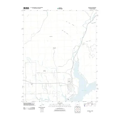
2010 Map of Allison
USGS Topo · Published 2010About this map
Navajo Reservoir dominates the southern landscape of this terrain where the Colorado and New Mexico borders meet. The settlement of Arboles sits perched near the northern reaches of the reservoir, while Allison serves as a western anchor for the local agricultural community. This area is defined by its complex irrigation infrastructure, including the North Pine River Lateral, Miller Ditch, and Darlington Ditch, which redirect water from the Piedra River and Sambrito Creek across the dry topography. To the north, the elevation rises significantly toward Piedra Peak and Piedra Peak Number 2, segmented by dramatic landforms such as Black Horse Canyon and Pine Tree Canyon. The presence of the Navajo Landing Strip near the shoreline suggests the intersection of remote recreation and local transport in this high-desert environment during the early 21st century.
Find a feature on this map
38 named features on this map. Tap any name to fly to it.
Don’t see what you’re looking for? This feature index may not catch every label — zoom into the map to look around manually.
Map Details
Editions of this 2010 Allison Map
This is the sole edition of this map. No revisions or reprints were ever made.
Other maps of this area

1889 · Largo
USGS Topo · 1:250,000

1895 · Largo
USGS Topo · 1:250,000

1908 · Ignacio
USGS Topo · 1:125,000

1924 · Ignacio
USGS Topo · 1:125,000

1924 · Pagosa Springs
USGS Topo · 1:125,000

1927 · Pagosa Springs
USGS Topo · 1:125,000

1945 · Durango
USGS Topo · 1:250,000

1953 · Durango
USGS Topo · 1:250,000

1954 · Durango
USGS Topo · 1:250,000

1954 · Allison
USGS Topo · 1:24,000