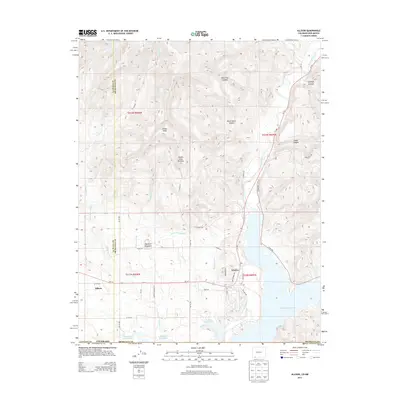
2013 Map of Allison
USGS Topo · Published 2013About this map
Allison and Arboles anchor this landscape along the border of La Plata and Archuleta counties, where the high desert meets the northern reaches of the Navajo Reservoir. The terrain is defined by the descent of the Piedra River and various arroyos toward the reservoir, managed by an intricate network of irrigation infrastructure including the Miller Ditch, Darlington Ditch, and the N Pine River Lateral. These waterways supported the local agricultural economy in a region otherwise dominated by sharp topographic rises like Haystack Mountain and the dual summits of Piedra Peak and Piedra Peak Number 2. Deep incisions such as Pine Tree Canyon and Black Horse Canyon carve through the northern sections, illustrating the transition from upland mesas to the water-rich basins below. This area reflects a mid-twentieth-century transformation from traditional ranching and farming to a landscape increasingly shaped by large-scale water reclamation and storage projects.
Find a feature on this map
41 named features on this map. Tap any name to fly to it.
Don’t see what you’re looking for? This feature index may not catch every label — zoom into the map to look around manually.
Map Details
Editions of this 2013 Allison Map
This is the sole edition of this map. No revisions or reprints were ever made.
Other maps of this area

1889 · Largo
USGS Topo · 1:250,000

1895 · Largo
USGS Topo · 1:250,000

1908 · Ignacio
USGS Topo · 1:125,000

1924 · Ignacio
USGS Topo · 1:125,000

1924 · Pagosa Springs
USGS Topo · 1:125,000

1927 · Pagosa Springs
USGS Topo · 1:125,000

1945 · Durango
USGS Topo · 1:250,000

1953 · Durango
USGS Topo · 1:250,000

1954 · Durango
USGS Topo · 1:250,000

1954 · Allison
USGS Topo · 1:24,000