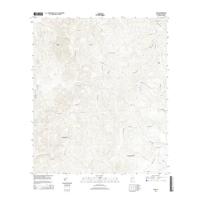
2014 Map of Alma
USGS Topo · Published 2014About this map
Rockville and the high ground of Roundtop Hill define the western reaches of this Clarke County landscape, where deep creek valleys cut through the Alabama coastal plain. This 2014 survey captures a rural territory dominated by family-named landmarks and long-established road networks, such as Walker Springs Rd and Byrd Jackson Rd. The topography is shaped by an intricate drainage system including Salt Cr and Reedy Cr, which flow toward the lower elevations near Choctaw Bluff in the southeast.
Find a feature on this map
47 named features on this map. Tap any name to fly to it.
Don’t see what you’re looking for? This feature index may not catch every label — zoom into the map to look around manually.
Map Details
Editions of this 2014 Alma Map
This is the sole edition of this map. No revisions or reprints were ever made.
Other maps of this area

1943 · Choctaw Bluff
USGS Topo · 1:62,500

1946 · Choctaw Bluff
USGS Topo · 1:62,500

1953 · Andalusia
USGS Topo · 1:250,000

1957 · Andalusia
USGS Topo · 1:250,000

1972 · Chrysler
USGS Topo · 1:24,000

1972 · Gainestown
USGS Topo · 1:24,000

1972 · Suggsville
USGS Topo · 1:24,000

1978 · Jackson
USGS Topo · 1:24,000
1978 · Walker Springs
USGS Topo · 1:24,000
1983 · Alma
USGS Topo · 1:24,000