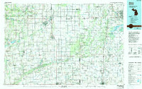
1985 Map of Alma
USGS Topo · Published 1991About this map
Alma and St Louis serve as the primary hubs in this central Michigan landscape, where the Pine River snakes through a region defined by its productive farmland and extensive drainage networks. The map details a dense grid of rural settlements such as Ithaca, Middleton, and Pompeii, reflecting a well-established agricultural economy in the mid-1980s. A complex transportation web is visible, featuring the Chesapeake & Ohio RR, Ann Arbor RR, and Grand Trunk Western RR, which connect the small towns to larger markets. To the east, the Shiawassee National Wildlife Refuge and Shiawassee River State Game Area provide a contrast to the geometric section lines, preserving wetlands and river bottoms. Local heritage is grounded in landmarks like St Andrew Ch and Oakwood Cem, while many smaller hamlets like Elm Hall and Sickles offer a view into the community structures of Gratiot and neighboring counties during this era.
Find a feature on this map
205 named features on this map. Tap any name to fly to it.
Don’t see what you’re looking for? This feature index may not catch every label — zoom into the map to look around manually.
Map Details
Editions of this 1985 Alma Map
2 editions found
Other maps of this area

1916 · Bay City
USGS Topo · 1:62,500

1916 · Mount Pleasant
USGS Topo · 1:62,500

1916 · Ionia
USGS Topo · 1:62,500

1917 · Chesaning
USGS Topo · 1:62,500

1917 · St. Charles
USGS Topo · 1:62,500

1918 · Elsie
USGS Topo · 1:62,500

1918 · Ionia
USGS Topo · 1:62,500

1918 · Perrinton
USGS Topo · 1:62,500

1919 · Mount Pleasant
USGS Topo · 1:62,500

1919 · Bay City
USGS Topo · 1:62,500