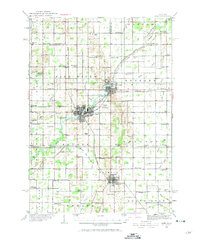
1935 Map of Alma
USGS Topo · Published 1971About this map
St Louis and Alma emerge as the primary industrial and population centers of central Michigan in this mid-1930s survey, defined by the junction of the Ann Arbor Railroad and the Pere Marquette Railroad. The Pine River meanders through these twin hubs, while to the south, Ithaca serves as a structured grid settlement and a focal point for the surrounding townships. The landscape is intensely subdivided into a dense network of sections, punctuated by dozens of rural district schools such as Irishtown Sch and Jack Day Sch.
Find a feature on this map
93 named features on this map. Tap any name to fly to it.
Don’t see what you’re looking for? This feature index may not catch every label — zoom into the map to look around manually.
Map Details
Editions of this 1935 Alma Map
2 editions found
Other maps of this area

1916 · Mount Pleasant
USGS Topo · 1:62,500

1918 · Elsie
USGS Topo · 1:62,500

1918 · Perrinton
USGS Topo · 1:62,500

1919 · Mount Pleasant
USGS Topo · 1:62,500

1930 · Shepherd
USGS Topo · 1:48,000

1934 · Sanford
USGS Topo · 1:62,500

1934 · Merrill
USGS Topo · 1:62,500

1935 · Alma
USGS Topo · 1:62,500

1936 · Shepherd
USGS Topo · 1:62,500

1936 · Sanford
USGS Topo · 1:62,500