
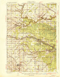
1936 Map of Shepherd
USGS Topo · Published 1936About this map
The Chippewa River and Salt River systems dominate this central Michigan landscape, as surveyed just before the mid-1930s. The village of Shepherd serves as a primary hub in the south, while smaller settlements like Oil City, Delwin, and Leaton dot the rural countryside. The agricultural and timber character of the era is evidenced by a dense network of country schools, including the Polish Sch, Alembic Sch, and Maple Grove Sch, many of which represent community centers for early Isabella and Midland County families.
Find a feature on this map
78 named features on this map. Tap any name to fly to it.
Don’t see what you’re looking for? This feature index may not catch every label — zoom into the map to look around manually.
Map Details
Editions of this 1936 Shepherd Map
2 editions found
Other maps of this area

1916 · Mount Pleasant
USGS Topo · 1:62,500

1919 · Mount Pleasant
USGS Topo · 1:62,500

1930 · Shepherd
USGS Topo · 1:48,000

1934 · Sanford
USGS Topo · 1:62,500

1934 · Merrill
USGS Topo · 1:62,500

1935 · Alma
USGS Topo · 1:62,500

1936 · Sanford
USGS Topo · 1:62,500

1937 · Merrill
USGS Topo · 1:62,500

1938 · Alma
USGS Topo · 1:62,500

1943 · Mount Pleasant
USGS Topo · 1:62,500