
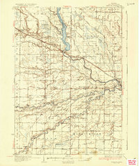
1936 Map of Sanford
USGS Topo · Published 1936About this map
Sanford Wild Life Refuge and the expansive Sanford Lake dominate the northern landscape of this mid-1930s survey, illustrating a region defined by its complex drainage networks and conservation efforts. The Tittabawassee River and Pine River meander through the central and southern reaches, where the local economy and social life are marked by a dense grid of rural schoolhouses such as St Elmo Sch, Riverside Sch, and Bishop Sch.
Find a feature on this map
107 named features on this map. Tap any name to fly to it.
Don’t see what you’re looking for? This feature index may not catch every label — zoom into the map to look around manually.
Map Details
Editions of this 1936 Sanford Map
2 editions found
Other maps of this area

1917 · St. Charles
USGS Topo · 1:62,500

1930 · Shepherd
USGS Topo · 1:48,000

1934 · Sanford
USGS Topo · 1:62,500

1934 · Merrill
USGS Topo · 1:62,500

1935 · Alma
USGS Topo · 1:62,500

1936 · Shepherd
USGS Topo · 1:62,500

1937 · Merrill
USGS Topo · 1:62,500

1938 · Alma
USGS Topo · 1:62,500

1943 · St. Charles
USGS Topo · 1:62,500

1954 · Midland
USGS Topo · 1:250,000