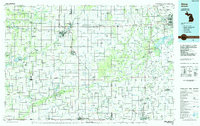
1985 Map of Alma
USGS Topo · Published 1985About this map
Alma and St Louis serve as the central hubs of this mid-1980s landscape, where the Pine River and Chesapeake and Ohio RR define the local infrastructure. The region is characterized by a dense network of drainage systems and creeks, such as Bush Creek and Beaver Creek, supporting the agricultural character of central Michigan. For genealogists, the map preserves the locations of local landmarks like Riverside Cem and Oak Grove Cem, alongside small rural intersections like New Haven Center and North Star.
Find a feature on this map
136 named features on this map. Tap any name to fly to it.
Don’t see what you’re looking for? This feature index may not catch every label — zoom into the map to look around manually.
Map Details
Editions of this 1985 Alma Map
2 editions found
Other maps of this area

1916 · Bay City
USGS Topo · 1:62,500

1916 · Mount Pleasant
USGS Topo · 1:62,500

1916 · Ionia
USGS Topo · 1:62,500

1917 · Chesaning
USGS Topo · 1:62,500

1917 · St. Charles
USGS Topo · 1:62,500

1918 · Elsie
USGS Topo · 1:62,500

1918 · Ionia
USGS Topo · 1:62,500

1918 · Perrinton
USGS Topo · 1:62,500

1919 · Mount Pleasant
USGS Topo · 1:62,500

1919 · Bay City
USGS Topo · 1:62,500