
1919 Map of Alma
USGS Topo · Published 1919About this map
The International Boundary Line defines the northern edge of this territory, where the High Plains of Montana meet the border of Canada. In the early twentieth century, the southern portion of the region saw significant development along the Great Northern R. R., which facilitated the establishment of grain-hauling settlements like Joplin, Inverness, Rudyard, and Bison. This corridor contrasts sharply with the sparse northern landscape, dominated by intermittent drainage systems such as Sage Creek and Kennedy Creek.
Find a feature on this map
25 named features on this map. Tap any name to fly to it.
Don’t see what you’re looking for? This feature index may not catch every label — zoom into the map to look around manually.
Map Details
Editions of this 1919 Alma Map
This is the sole edition of this map. No revisions or reprints were ever made.
Other maps of this area

1919 · Big Sandy
USGS Topo · 1:125,000

1920 · Gildford
USGS Topo · 1:125,000

1943 · Gildford
USGS Topo · 1:125,000

1954 · Shelby
USGS Topo · 1:250,000

1958 · Shelby
USGS Topo · 1:250,000

1962 · Tiber
USGS Topo · 1:24,000
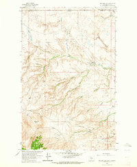
1962 · Bingham Lake
USGS Topo · 1:24,000

1962 · Lakey Ranch
USGS Topo · 1:24,000

1962 · Mount Lebanon
USGS Topo · 1:24,000

1963 · Joplin
USGS Topo · 1:24,000