
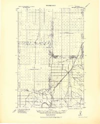
1919 Map of Big Sandy
USGS Topo · Published 1919About this map
The Great Northern Railway Line serves as the central spine of this 1919 study, connecting the high plains settlements of Laredo, Boxelder, and Big Sandy as it heads toward the Missouri River. Compiled under the direction of Col. Chas. L. Potter, the map illustrates a landscape defined by its drainage patterns, where intricate coulee systems like Fourteen Mile Coulee and Rainbow Coulee carve through the terrain toward larger water bodies such as Lonesome Lake.
Find a feature on this map
26 named features on this map. Tap any name to fly to it.
Don’t see what you’re looking for? This feature index may not catch every label — zoom into the map to look around manually.
Map Details
Editions of this 1919 Big Sandy Map
2 editions found
Other maps of this area

1890 · Fort Benton
USGS Topo · 1:250,000

1892 · Fort Benton
USGS Topo · 1:250,000

1897 · Fort Benton
USGS Topo · 1:250,000

1904 · Assinniboine
USGS Topo · 1:62,500

1904 · Boxelder
USGS Topo · 1:62,500

1906 · Kremlin
USGS Topo · 1:62,500

1906 · Lonesome
USGS Topo · 1:62,500

1906 · Boxelder
USGS Topo · 1:62,500

1912 · Thibedeau Lake
USGS Topo · 1:125,000

1919 · Alma
USGS Topo · 1:125,000