Old Maps of Chouteau County, Montana
Explore 684 old maps of Chouteau County, spanning from 1886 to today. These high-resolution historic maps reveal how streets, neighborhoods, landmarks, and natural features evolved over time — perfect for genealogy, metal detecting, research, and local history exploration.
What you can do with these maps:
- See how Chouteau County changed over time: Compare historical maps to modern-day views to trace roads, homesites, rail lines & more.
- View detailed metadata: Each map includes creators, publishers, year, scale, and archive source.
- Overlay maps with satellite & LiDAR: Visualize the past alongside modern tools to explore terrain & human change.
- Trusted historical sources: Maps sourced from the USGS, Library of Congress, and other archives.
- Access maps your way: View online, download high-res files, or order prints for personal or research use.
Start exploring old maps of Chouteau County to uncover forgotten places, hidden landmarks, and the deep history beneath your feet.
Chouteau County, MT maps
(684)- 1886 Map of Great Falls
 1886 Great Falls1886 Print · USGSCentral Montana in the mid-1880s is defined by its great river systems and the early footprints of frontier outposts. Researchers can trace the early development of Great Falls, find the site of St. Peter's Mission, and locate river settlements like Truly and Fort Shaw.4 unique versions available
 - 1890 Map of Fort Benton
 1890 Fort Benton1890 Print · USGSUpper Missouri river country was transforming in the late nineteenth century as rail lines and ranching settlements expanded across the plains. Genealogists and historians can trace early land routes between Fort Benton, Stanford, and the mining district around Clendenin.
 - 1892 Map of Fort Benton
 1892 Fort Benton1892 Print · USGSUpper Missouri River country in the late nineteenth century shows the transition from river commerce to the iron horse. Genealogists and historians can trace early settlements like Stanford and Fort Benton alongside the St Paul Minneapolis and Manitoba Railroad.
 - 1897 Map of Fort Benton
 1897 Fort Benton1897 Print · USGSUpper Missouri River territory is charted here during its transition from a river-based economy to a rail-and-ranching frontier. Researchers can trace the early layouts of Fort Benton and Stanford, or locate remote sites like Barker Mtn and Riceville.4 unique versions available
 - 1904 Map of Boxelder, 1959 Print
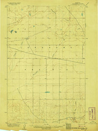
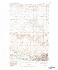
 1904 Boxelder1959 Print · USGSChouteau County was a land of sprawling cattle ranches and newly laid tracks at the start of the 1900s. Genealogists and local historians can trace early homesteads like Armentrout's Ranch and follow the route of the Great Northern R R.
 - 1906 Map of Lonesome
 1906 Lonesome1906 Print · USGSLonesome Prairie in north-central Montana appears here at the dawn of the twentieth century, before widespread settlement. Researchers can locate early outposts like Godfrey's Ranch and trace the drainage of Fourteenmile Coulee and Dry Fork Coulee.2 unique versions available
 - 1906 Map of Boxelder
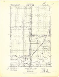
 1906 Boxelder1906 Print · USGSThe northern Montana high plains are captured here in the early twentieth century as the railroad transformed the ranching economy. Genealogists and local historians can locate early family holdings like Schwartz's Ranch and Wedeking's Ranch or trace the Great Northern RR through Boxelder.
 - 1919 Map of Big Sandy
 1919 Big Sandy1919 Print · USGSBig Sandy and the plains of Northern Montana are captured here just after the Great War, as the railroad and river trade defined local life. Genealogists and historians can trace the Great Northern Railway Line through Boxelder and Virgelle, or locate the Ferry crossing on the Missouri River.2 unique versions available
 - 1948 Map of Portage
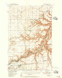 1948 Portage1948 Print · USGSThe Missouri River corridor near Great Falls is shown in the late 1940s, a landscape shaped by hydroelectric dams and expanding military aviation. Genealogists and researchers can trace local landmarks like Goffe Ranch, Salem Sch, and the Great Northern rail lines.4 unique versions available
 - 1949 Map of Portage
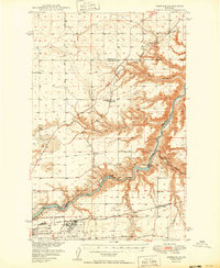 1949 Portage1949 Print · USGSThe Missouri River breaks through the Montana high plains in the late 1940s, revealing a landscape of vital hydroelectric dams and rural rail stops. Local historians can trace the development of Morony Dam, family holdings at Golie Ranch, and early settlements like Portage.2 unique versions available
 - 1949 Map of Timber Coulee, 1963 Print
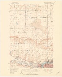
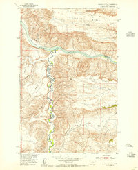
 1949 Timber Coulee1963 Print · USGSTeton and Chouteau counties are shown here in the late 1940s, when the agricultural life of the Montana plains was tied to the river valley and small country schoolhouses. Researchers can locate the Jensen Elevator, follow the historic Bootlegger Trail, and find local landmarks like Knee Church.2 unique versions available
 - 1949 Map of Great Falls, 1966 Print
 1949 Great Falls1966 Print · USGSMid-century Great Falls and the Missouri River basin are shown here during a period of post-war industrial and educational expansion. Researchers can trace the heritage of the area via the Bootlegger Trail, the Black Eagle Dam, and schools like Ursuline Academy and McKinley Sch.
 - 1950 Map of Timber Coulee
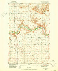
 1950 Timber Coulee1950 Print · USGSMontana's high prairie and river breaks are documented here in the mid-1940s, showing a landscape defined by the winding Teton River. Genealogists and local historians can trace the locations of the Knee Church, the Jensen Elevator, and early rural schools like Promised Land School.
 - 1950 Map of Dent Bridge
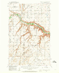
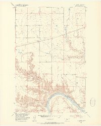
 1950 Dent Bridge1950 Print · USGSChouteau County was a landscape of remote prairie schools and river breaks in the years following the war. Researchers can trace rural genealogy and land use through landmarks like Promised Land School No 2, Dent Bridge, and the winding Teton River.3 unique versions available
 - 1951 Map of Great Falls
 1951 Great Falls1951 Print · USGSGreat Falls and the surrounding Cascade County plains come alive in this mid-century survey of the Missouri River basin. Genealogists and local historians can trace the early layout of Black Eagle, locate the Ursuline Academy, and follow the historic Bootlegger Trail.2 unique versions available
 - 1953 Map of Boggs Island, 1954 Print
 1953 Boggs Island1954 Print · USGSChouteau County ranching lands and Missouri River crossings are documented here in the early fifties. Genealogists and local historians can trace the rural infrastructure of the era, including the Virgelle Ferry, the Mt Vernon School, and the settlement of Virgelle.3 unique versions available
 - 1953 Map of Rocky Lake, 1954 Print
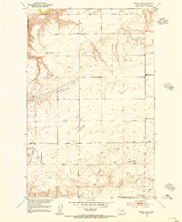 1953 Rocky Lake1954 Print · USGSChouteau County in the early fifties shows a high-plains landscape defined by its vital water sources and rural schoolhouses. Researchers can trace the locations of Elim School, Harwood School, and the remote Rocky Lake.2 unique versions available
 - 1953 Map of Loma East, 1954 Print
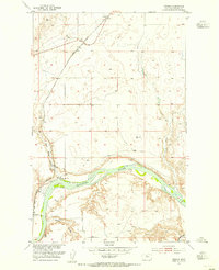
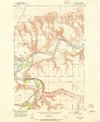 1953 Loma East1954 Print · USGSChouteau County in the early fifties shows the vital junction of the Missouri and Marias Rivers before the modern era. Researchers can trace the river economy through labels like Loma Ferry, the Great Northern rail stops at Chappell, and the West Wayside School.2 unique versions available
 - 1953 Map of Carter, 1954 Print
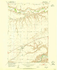 1953 Carter1954 Print · USGSThe high plains of Chouteau County come into focus during the early fifties, where the railroad and river define the pace of rural life. Local historians can trace the foundations of the community at Carter, the Baack School, and the riverfront at Carter Ferry.3 unique versions available
 - 1953 Map of Starve Out Flat, 1955 Print
 1953 Starve Out Flat1955 Print · USGSChouteau and Fergus Counties were still defined by remote ranching and river breaks in the early fifties. Local historians can trace early water sources like the Artesian Well and Cow Camp Spring near the dramatic landforms of The Big Sag.2 unique versions available
 - 1953 Map of Eagle Buttes, 1955 Print
 1953 Eagle Buttes1955 Print · USGSChouteau County in the early fifties is captured here as a landscape of river breaks and upland grazing. Local historians can trace the Hole-in-the-Wall Trail or locate the Sexton Coal Mines and the Cem near Graceville.
 - 1953 Map of Verona, 1955 Print
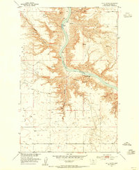
 1953 Verona1955 Print · USGSThe Missouri River valley in Chouteau County during the early fifties reveals a landscape of transition between river history and rail industry. You can trace the Great Northern railway as it passes through Verona and locate the historic Coal Banks Landing (Site).2 unique versions available
 - 1953 Map of Last Chance Bench, 1955 Print
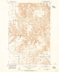 1953 Last Chance Bench1955 Print · USGSThe high plains of Chouteau County come into focus during the mid-fifties, revealing a ranching landscape defined by the Missouri River. Trace old family landmarks and terrain breaks like Wild Horse Butte, Canavan Bench, and Fahlgren Coulee.2 unique versions available
 - 1953 Map of Big Bend School, 1955 Print
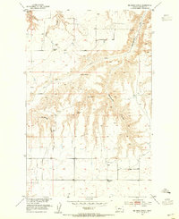 1953 Big Bend School1955 Print · USGSChouteau County's rural plains are captured here in the early fifties, showing the scattered outposts of Montana's ranching frontier. Researchers can pinpoint early educational sites like Big Bend School, landmarks like Chimney Rock, and water sources such as McCullen Spring.2 unique versions available
 - 1953 Map of Lonetree Coulee, 1955 Print
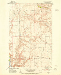 1953 Lonetree Coulee1955 Print · USGSChouteau County in the early fifties shows a rugged Montana landscape shaped by the Missouri River Basin development program. Genealogists and researchers can trace the location of the Lonetree Sch (Aband) and navigate the deep drainages of Lonetree Coulee and Alkali Coulee.2 unique versions available
Showing maps 1-25 of 684
Top cities of Chouteau County
Frequently asked questions
- What are the different types of historical maps available for Chouteau County?
- What is the oldest map of Chouteau County?
- Where can I purchase historical maps of Chouteau County for my home or office?
- Where can I download high-res historical maps of Chouteau County?
- Are there historical topographic maps available for Chouteau County?
- Is there historical aerial imagery available for Chouteau County?
- Where are historical maps of Chouteau County sourced from?