
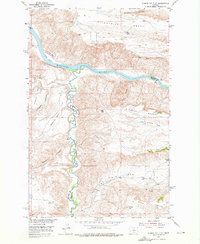
1953 Map of Starve Out Flat
USGS Topo · Published 1955About this map
The Missouri River carves through the central landscape of this 1953 survey, marking the boundary between Chouteau and Fergus Counties. The terrain is characterized by a series of distinct benches and coulees, where the upland flats drop sharply into deep river breaks. To the south, Arrow Creek meanders north toward its confluence with the Missouri, defining the namesake Starve Out Flat and Fahlgren Flat.
Find a feature on this map
26 named features on this map. Tap any name to fly to it.
Don’t see what you’re looking for? This feature index may not catch every label — zoom into the map to look around manually.
Map Details
Editions of this 1953 Starve Out Flat Map
2 editions found
Other maps of this area

1953 · Last Chance Bench
USGS Topo · 1:24,000

1954 · P N Ranch
USGS Topo · 1:24,000

1954 · Iliad
USGS Topo · 1:24,000

1954 · Dark Butte
USGS Topo · 1:24,000

1954 · Lewistown
USGS Topo · 1:250,000

1959 · Lewistown
USGS Topo · 1:250,000

1964 · Wolf Creek Falls
USGS Topo · 1:24,000

1964 · Pigtail Coulee
USGS Topo · 1:24,000

1964 · Spring Coulee
USGS Topo · 1:24,000
1978 · Steele Lake Coulee
USGS Topo · 1:24,000