
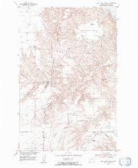
1953 Map of Last Chance Bench
USGS Topo · Published 1955About this map
Last Chance Bench dominates this high plains landscape in Chouteau County, where the terrain breaks sharply toward the Missouri River in the northeast. Surveyed as part of the Department of the Interior's post-war program for the Missouri River Basin, the map reveals a network of deep drainage coulees that define the local geography. Family names and local identifiers are etched into the land via features like Fahlgren Coulee, Nance Coulee, and Dossett Coulee.
Find a feature on this map
23 named features on this map. Tap any name to fly to it.
Don’t see what you’re looking for? This feature index may not catch every label — zoom into the map to look around manually.
Map Details
Editions of this 1953 Last Chance Bench Map
2 editions found
Other maps of this area

1890 · Fort Benton
USGS Topo · 1:250,000

1892 · Fort Benton
USGS Topo · 1:250,000

1897 · Fort Benton
USGS Topo · 1:250,000

1953 · Starve Out Flat
USGS Topo · 1:24,000

1953 · Eagle Buttes
USGS Topo · 1:24,000

1954 · Great Falls
USGS Topo · 1:250,000

1954 · Iliad
USGS Topo · 1:24,000

1954 · Dark Butte
USGS Topo · 1:24,000

1954 · Lewistown
USGS Topo · 1:250,000

1957 · Great Falls
USGS Topo · 1:250,000