1970s Maps of Chouteau County, Montana
Explore 41 historic maps of Chouteau County from the 1970s. These maps offer a rare glimpse into what life looked like during the 1970s — showing old roads, neighborhoods, homes, and landmarks that have changed or disappeared over time.
Whether you're researching your family's past, planning a metal detecting trip, or studying how Chouteau County's landscape evolved across the 1970s, these high-resolution maps are a powerful tool for exploring the history of this region.
- Focus on a specific era: All maps on this page are from the 1970s, giving you a focused view of this time period.
- See what’s changed: Compare century-old streets, trails, and buildings to today's modern landscape using overlays and satellite layers.
- Research with precision: Use these maps for genealogy, historical research, land use analysis, or educational projects.
- View, download, or print: Maps are fully viewable online in high resolution, and can be downloaded or printed for your own records.
Start exploring Chouteau County's history through authentic maps from the 1970s. This is your window into the past.
Chouteau County, MT maps
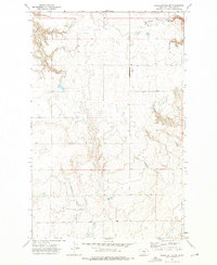
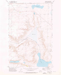
(41)- 1970 Map of Carlson Coulee, 1973 Print
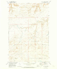
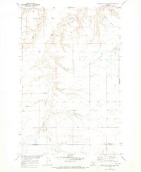
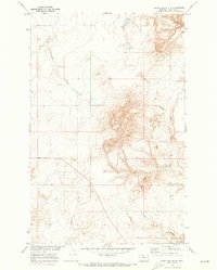
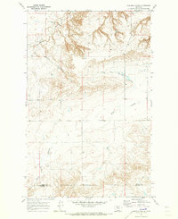 1970 Carlson Coulee1973 Print · USGSThe northern Montana high plains appear in the early seventies, centered on the settlement of Armstrong. Local historians can trace the deep erosional cuts of Pondera Coulee and Alkali Springs Coulee or follow the historic Bootlegger Trail.
 - 1970 Map of Penzer School, 1973 Print
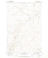
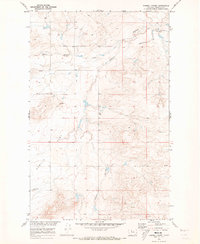
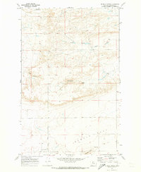
 1970 Penzer School1973 Print · USGSThe northern plains of Liberty and Chouteau counties are captured here in the early 1970s, focused on the breaks of the Marias River. Researchers can locate the Penzer Sch and trace the deep drainage patterns of Dead Indian Coulee and Lees Lake.
 - 1970 Map of Knees NE, 1973 Print
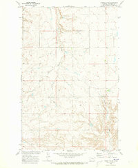
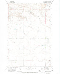
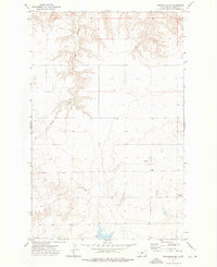
 1970 Knees NE1973 Print · USGSThe northern Montana plains are documented here in 1970, showing a landscape defined by ranching fences and the historic Bootlegger Trail. Researchers can trace the rugged topography of Dead Indian Coulee and locate St Olaf Ch.
 - 1970 Map of Dorner School, 1973 Print
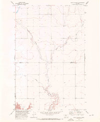
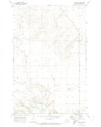
 1970 Dorner School1973 Print · USGSNorthern Chouteau County reveals its rural character in the early seventies, centered on isolated landmarks and seasonal drainages. Genealogists and local historians can locate Dorner School and trace the paths of East Dubout Coulee and Chimney Rock Coulee.
 - 1970 Map of Uphill Creek, 1973 Print
 1970 Uphill Creek1973 Print · USGSIn the high plains of north-central Montana during the early 1970s, the ranching country at the county line remained wide and open. Genealogists and land researchers can trace the rugged drainage of Uphill Creek and the sweeping terrain of Basin Coulee across the Liberty Co border.
 - 1970 Map of Rocky Coulee SE, 1973 Print
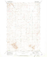
 1970 Rocky Coulee SE1973 Print · USGSThe Montana high plains at the start of the seventies reveal a landscape shaped by water and wind on the Hill and Chouteau county line. Local historians and land researchers can trace the meandering paths of Black Coulee and the Flat Coulee drainage system.
 - 1970 Map of Knees, 1973 Print
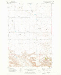
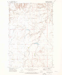
 1970 Knees1973 Print · USGSChouteau County's high plains appear in the early 1970s as a landscape of isolated ranching hubs and historic overland routes. Genealogists can trace the rural community center at Knees Sch and Knees Comm Hall or follow the path of the Bootlegger Trail.
 - 1970 Map of Sollid School, 1973 Print
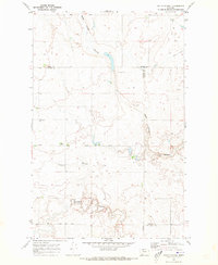 1970 Sollid School1973 Print · USGSThe Montana plains north of Conrad are captured here in the early seventies, showing a landscape defined by deep coulees and rural section lines. Researchers can locate the Sollid School, Golden West Ch, and Golden West Cem while tracing the winding Pondera Coulee.
 - 1970 Map of Goose Bill Butte NW, 1973 Print
 1970 Goose Bill Butte NW1973 Print · USGSLiberty and Chouteau counties appear in the early seventies as a vast agricultural landscape defined by deep coulees. Trace rural genealogy and land use through the local Cem, Storage Bins, and the winding path of Basin Coulee.
 - 1970 Map of Rocky Coulee SW, 1973 Print
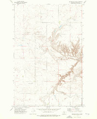
 1970 Rocky Coulee SW1973 Print · USGSHill County is captured in the early 1970s as a landscape of wide-open plains and deep river cuts. Historians can trace the winding path of the Marias River and locate the Gaging Sta and Flat Coulee drainage system.
 - 1970 Map of Russell Chapel, 1973 Print
 1970 Russell Chapel1973 Print · USGSChouteau County ranching country is captured here in the early seventies, showing a landscape of high flats and deep coulees. Researchers can locate the Russell Chapel and Sample Flat Cem, along with the Bar Z F Ranch and Stewart Ranch.
 - 1970 Map of Faris School, 1973 Print
 1970 Faris School1973 Print · USGSNorthern Montana prairie life in the early seventies centers on remote community hubs along the Pondera and Chouteau county line. Local historians can trace the foundations of the Faris School, the East Community Center, and the essential East Community Well.
 - 1970 Map of Goose Bill Butte, 1973 Print
 1970 Goose Bill Butte1973 Print · USGSNorthern Montana plains life in the early seventies centered on the distinct topography of Goose Bill Butte. Researchers can trace the drainage of this Chouteau County landscape through Dead Indian Coulee, Chip Creek, and Goose Bill Coulee.
 - 1970 Map of Mc Bridy Spring, 1973 Print
 1970 Mc Bridy Spring1973 Print · USGSThe high plains of Chouteau County in the early seventies are defined by remote ranching infrastructure and seasonal water sources. Trace family land-use patterns across Sample Flat or locate specific landmarks like McBridy Spring and the Landing Strips.
 - 1970 Map of Apple School, 1974 Print
 1970 Apple School1974 Print · USGSChouteau County's rural prairie comes into sharp focus during the 1970s, showing a landscape shaped by ranching and deep coulees. Researchers can locate the Apple School and trace the winding paths of Dry Fork Coulee and Chimney Rock Coulee.
 - 1970 Map of Carter NE, 1974 Print
 1970 Carter NE1974 Print · USGSChouteau County's high plains are documented here in the early seventies, showing a landscape defined by its deep drainages and the Teton River. You can trace named landmarks like Bullberry Coulee, Chimney Rock Coulee, and Frank Gilbert Coulee.
 - 1972 Map of Eagle Buttes SW, 1975 Print
 1972 Eagle Buttes SW1975 Print · USGSThe high plains of Chouteau County are captured in the early 1970s, showing the dramatic erosional breaks of the Montana landscape. Researchers can trace the complex drainage patterns of Sherry Coulee and Crow Coulee across these vast benchlands.
 - 1972 Map of Square Butte SE, 1976 Print
 1972 Square Butte SE1976 Print · USGSChouteau County ranching and aviation come to life in the early 1970s on this Montana high-plains survey. Researchers can trace local landmarks like Hawarden Hall, the Square Butte Bench Cem, and several remote Landing Strips.
 - 1972 Map of Square Butte, 1976 Print
 1972 Square Butte1976 Print · USGSThe area surrounding Square Butte in the early 1970s reveals a landscape of high Montana benches and essential rail corridors. Trace the path of the Milwaukee Road past Storage Bins and landmarks like the Chalk Cliffs.
 - 1972 Map of Stranahan SE, 1976 Print
 1972 Stranahan SE1976 Print · USGSChouteau County's high plains and deep ravines are captured here in the early seventies, showing a landscape defined by its rural isolation. Researchers can locate the Clear Lake Cemetery or trace the winding paths of Crow Coulee and Rowe Coulee.
 - 1972 Map of Montague, 1976 Print
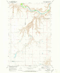
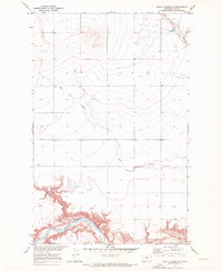
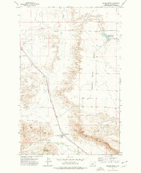
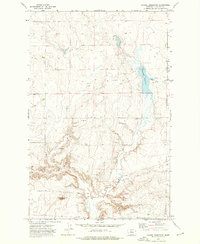
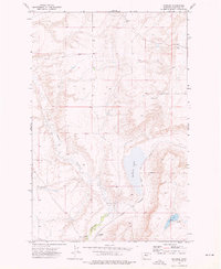
 1972 Montague1976 Print · USGSChouteau County's agricultural landscape is captured here in the early 1970s, centered on the rail-side community of Montague. Researchers can trace the legacy of the high plains grain trade through the Chicago Milwaukee St Paul and Pacific rail line, Grain Elevators, and landmarks like White Lake.
 - 1972 Map of Dammel Reservoir, 1976 Print
 1972 Dammel Reservoir1976 Print · USGSChouteau County in the early seventies shows an evolving agricultural landscape centered on water management. Researchers can trace land use patterns through scattered Storage Bins and landmarks like Haystack Butte and Dammel Reservoir.
 - 1972 Map of Shonkin NW, 1976 Print
 1972 Shonkin NW1976 Print · USGSThe high plains of Chouteau County are captured here in the early 1970s, showing a landscape shaped by seasonal water. Local history researchers can trace the winding paths of Spring Coulee and Ninemile Coulee or locate the industrial site at the Gravel Pit.
 - 1972 Map of Square Butte NE, 1976 Print
 1972 Square Butte NE1976 Print · USGSChouteau County's high plains and deep coulees are captured here in the early 1970s, showing a landscape defined by ranching and remote operations. Researchers can locate infrastructure like the Landing Strip and water sources including Flat Creek and numerous Well sites.
 - 1972 Map of Shonkin, 1976 Print
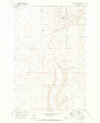
 1972 Shonkin1976 Print · USGSChouteau County in the early seventies shows a landscape centered on rail transport and water resources. Local historians can trace the Milwaukee Road tracks as they pass Shonkin Lake and the settlement of Shonkin.
Showing maps 1-25 of 41
Top cities of Chouteau County
Frequently asked questions
- What are the different types of historical maps available for Chouteau County?
- What is the oldest map of Chouteau County?
- Where can I purchase historical maps of Chouteau County for my home or office?
- Where can I download high-res historical maps of Chouteau County?
- Are there historical topographic maps available for Chouteau County?
- Is there historical aerial imagery available for Chouteau County?
- Where are historical maps of Chouteau County sourced from?