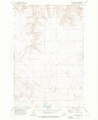
1972 Map of Stranahan SE
USGS Topo · Published 1976About this map
Chouteau County's landscape in the early 1970s is characterized by the intricate drainage systems that carve through the high plains. Extensive branching ravines like Crow Coulee and Rowe Coulee define the local topography, influencing how roads and land boundaries were established across the Montana countryside. This 1972 field-checked survey reveals a sparsely populated area where large-scale ranching or agricultural operations are supported by remote infrastructure, including a secluded Landing Strip in the southeastern portion of the quadrangle. For those tracing local family history or land ownership in this region, Clear Lake Cemetery serves as a significant genealogical marker amidst the section lines and coulees.
Find a feature on this map
4 named features on this map. Tap any name to fly to it.
Don’t see what you’re looking for? This feature index may not catch every label — zoom into the map to look around manually.
Map Details
Editions of this 1972 Stranahan SE Map
This is the sole edition of this map. No revisions or reprints were ever made.
Other maps of this area

1890 · Fort Benton
USGS Topo · 1:250,000

1892 · Fort Benton
USGS Topo · 1:250,000

1897 · Fort Benton
USGS Topo · 1:250,000

1953 · Rocky Lake
USGS Topo · 1:24,000

1953 · Loma East
USGS Topo · 1:24,000

1953 · Big Bend School
USGS Topo · 1:24,000

1953 · Stranahan
USGS Topo · 1:24,000

1954 · Great Falls
USGS Topo · 1:250,000

1957 · Great Falls
USGS Topo · 1:250,000
1972 · Eagle Buttes SW
USGS Topo · 1:24,000