1960s Maps of Chouteau County, Montana
Explore 23 historic maps of Chouteau County from the 1960s. These maps offer a rare glimpse into what life looked like during the 1960s — showing old roads, neighborhoods, homes, and landmarks that have changed or disappeared over time.
Whether you're researching your family's past, planning a metal detecting trip, or studying how Chouteau County's landscape evolved across the 1960s, these high-resolution maps are a powerful tool for exploring the history of this region.
- Focus on a specific era: All maps on this page are from the 1960s, giving you a focused view of this time period.
- See what’s changed: Compare century-old streets, trails, and buildings to today's modern landscape using overlays and satellite layers.
- Research with precision: Use these maps for genealogy, historical research, land use analysis, or educational projects.
- View, download, or print: Maps are fully viewable online in high resolution, and can be downloaded or printed for your own records.
Start exploring Chouteau County's history through authentic maps from the 1960s. This is your window into the past.
Chouteau County, MT maps
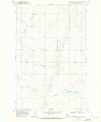
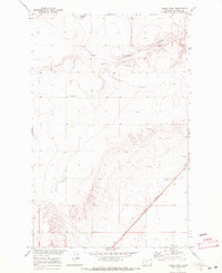
(23)- 1964 Map of Pigtail Coulee, 1966 Print
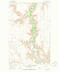
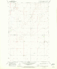
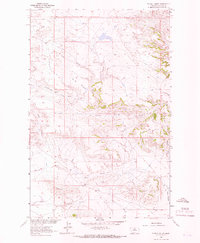 1964 Pigtail Coulee1966 Print · USGSChouteau County rangeland comes into focus in the mid-sixties as part of the Missouri River Basin development. Researchers can locate remote rural landmarks like the Eskay Sch, Kabo Sch, and family-named features including Lidstone Hill.
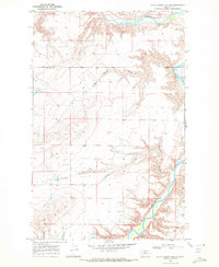
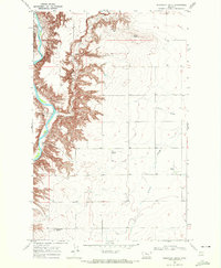
 - 1964 Map of Fort Benton NW, 1966 Print
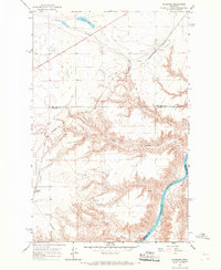
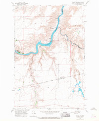
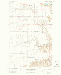 1964 Fort Benton NW1966 Print · USGSChouteau County ranching country is captured here in the mid-1960s, showing a high-plains landscape defined by coulees and the winding river. Researchers can locate the Pleasant Valley Sch and trace the drainage of the Marias River and Dry Fork Coulee.
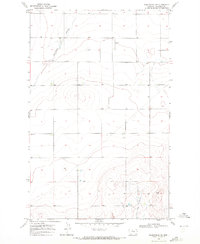
 - 1964 Map of Spring Coulee, 1966 Print
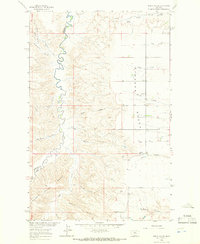 1964 Spring Coulee1966 Print · USGSThe ranching country of Fergus County is captured in the mid-1960s as it straddles the rugged breaks of the Arrow Creek canyon. Genealogists and local historians can trace family ties at the Everson Cem, the Lincoln Sch, and the Everson Community Hall.2 unique versions available
 - 1964 Map of Chase Hill, 1966 Print
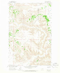 1964 Chase Hill1966 Print · USGSNorth-central Montana's high-plain benchlands are captured in the mid-1960s at the intersection of Chouteau and Blaine counties. Local historians can trace the drainage patterns of Wolf Coulee and Black Coulee between landmarks like Greens Bench and Chase Hill.
 - 1964 Map of Day School SW, 1966 Print
 1964 Day School SW1966 Print · USGSChouteau County's river breaks are captured in the mid-1960s as they served a growing Missouri River Basin development plan. Researchers can trace land use through cattle industry features like the Corral and isolated structures such as the Storage Bins near Marias River.
 - 1964 Map of Day School, 1966 Print
 1964 Day School1966 Print · USGSChouteau County ranching country is documented here in the mid-1960s as part of the Missouri River Basin project. Genealogists can locate rural landmarks like Watson, Day Sch, and the Nelson Southside Sch.2 unique versions available
 - 1965 Map of Benton Lake West, 1967 Print
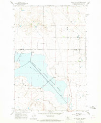
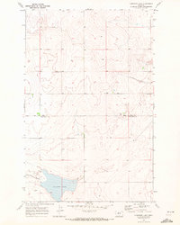
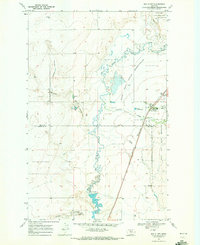
 1965 Benton Lake West1967 Print · USGSThe northern Montana prairie and the sprawling wetlands of the Benton Lake National Wildlife Refuge are captured here in the mid-1960s. Researchers can trace the boundaries of three counties and locate specific land-use markers like a Pipeline, Well, and Gravel Pit.2 unique versions available
 - 1965 Map of Floweree, 1967 Print
 1965 Floweree1967 Print · USGSThe Montana high plains north of Great Falls are captured here in the mid-1960s, showing the intersection of the Great Northern rail line and the Missouri River. Researchers can trace the rural communities of Floweree and Portage alongside rugged features like Widow Coulee.2 unique versions available
 - 1965 Map of Morony Dam, 1968 Print
 1965 Morony Dam1968 Print · USGSHydroelectric power and rail transport define this stretch of the Missouri River in the mid-1960s. Researchers can trace the industrial footprint of Morony Dam and Ryan Dam, or locate the Salem Sch and Grain Elevator along the railroad line.2 unique versions available
 - 1965 Map of Flick Lake, 1968 Print
 1965 Flick Lake1968 Print · USGSThe high plains of Chouteau and Cascade counties come alive in the mid-1960s, showing a landscape defined by ranching and rail. Trace the Great Northern railroad corridor through Portage, and locate local landmarks like the Roosevelt Sch and Twenty-eight Mile Spring.2 unique versions available
 - 1965 Map of Benton Lake East, 1968 Print
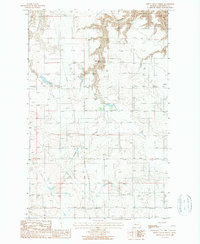
 1965 Benton Lake East1968 Print · USGSNorth-central Montana's prairie wetlands are showcased in the mid-sixties, focusing on the managed waters of the Benton Lake National Wildlife Refuge. Researchers can trace the historic Bootlegger Trail and locate the rural Swall Sch.2 unique versions available
 - 1965 Map of Sheep Coulee Spring, 1987 Print
 1965 Sheep Coulee Spring1987 Print · USGSNorth-central Montana's high plains are captured here in the mid-1960s, showing a landscape defined by seasonal water and emerging infrastructure. Researchers can trace the rugged topography of Wolf Coulee and locate the vital Sheep Coulee Spring.
 - 1969 Map of Fourteenmile Coulee SW, 1972 Print
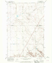
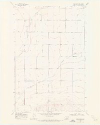
 1969 Fourteenmile Coulee SW1972 Print · USGSThe Montana prairie straddling the border of Hill and Chouteau counties is captured here in the late sixties, showing the reach of seasonal drainages. Researchers can trace the courses of Black Coulee and Sixmile Coulee or locate rural landmarks like isolated Storage Bins.
 - 1969 Map of Lonesome Lake, 1972 Print
 1969 Lonesome Lake1972 Print · USGSThe Montana prairie at the turn of the 1970s reveals a sparse landscape of ranching and drainage coulees across the Hill and Chouteau county line. Genealogists and historians can trace local landmarks like Lonesome Lake and the intermittent waters of Twelvemile Coulee.
 - 1969 Map of Big Sandy, 1972 Print
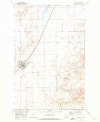 1969 Big Sandy1972 Print · USGSBig Sandy and the northern Montana plains are documented here in the late sixties as the regional rail and ranching economy matured. Researchers can locate the Miley Sch, trace the Burlington Northern tracks, and identify landmarks like Rattlesnake Butte.
 - 1969 Map of Kenilworth, 1972 Print
 1969 Kenilworth1972 Print · USGSChouteau County's rural landscape is captured here in the late sixties, showing the agricultural patterns of north-central Montana. Researchers can trace the layout of Kenilworth, locate Kenilworth Cem, and follow the deep paths of Sixmile Coulee.
 - 1969 Map of Fourteenmile Coulee SE, 1972 Print
 1969 Fourteenmile Coulee SE1972 Print · USGSThe border of Hill and Chouteau counties was a landscape of deep drainage coulees and prairie industry in the late sixties. Researchers can trace the winding Fourteenmile Coulee past local Gravel Pits and isolated Storage Bins.
 - 1969 Map of Dutch Henry Coulee, 1972 Print
 1969 Dutch Henry Coulee1972 Print · USGSNorth-central Montana’s cattle country is surveyed here in the late sixties, highlighting the deep breaks of the northern plains. Researchers can trace the winding Marias River and the rural settlement at Shepard through the rugged Fourmile Coulee terrain.
 - 1969 Map of Kenilworth SW, 1972 Print
 1969 Kenilworth SW1972 Print · USGSChouteau County's high plains are revealed in the late sixties as a landscape of deep drainage coulees and historic transit corridors. Trace the path of the Lewis and Clark Trail alongside infrastructure remnants like the Old RR Grade and the Schlack landmark.
 - 1969 Map of Box Elder, 1972 Print
 1969 Box Elder1972 Print · USGSBox Elder and the western edge of the Rocky Boy's Reservation are captured in the late sixties as the rail and ranching economy thrived. Genealogists and local historians can trace the Burlington Northern line and locate the Cem and Rocky Crossing.
 - 1969 Map of Ihmsen Well, 1972 Print
 1969 Ihmsen Well1972 Print · USGSChouteau County in the late sixties shows a vast ranching and grain landscape shaped by the Missouri River Basin project. Map collectors and researchers can trace the diagonal path of the Burlington Northern alongside the historic Lewis and Clark Trail near Ihmsen Well 2758.
 - 1969 Map of Discovery Butte, 1972 Print
 1969 Discovery Butte1972 Print · USGSThe breaks of the Marias River meet the Chouteau County high plains in the late 1960s. Genealogists and historians can trace the Bessette Ranch and landforms like Discovery Butte and Black Butte during this era of remote prairie ranching.
 - 1969 Map of Kenilworth NE, 1972 Print
 1969 Kenilworth NE1972 Print · USGSRanching lands in Chouteau County appear in the late sixties as a landscape of wide coulees and remote outposts. Genealogists and historians can trace local landmarks like Lincoln Sch, the Landing Strip, and the winding Twelvemile Coulee.
End of results
Showing maps 1-23 of 23
Top cities of Chouteau County
Frequently asked questions
- What are the different types of historical maps available for Chouteau County?
- What is the oldest map of Chouteau County?
- Where can I purchase historical maps of Chouteau County for my home or office?
- Where can I download high-res historical maps of Chouteau County?
- Are there historical topographic maps available for Chouteau County?
- Is there historical aerial imagery available for Chouteau County?
- Where are historical maps of Chouteau County sourced from?