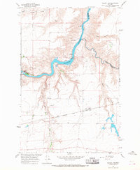
1965 Map of Morony Dam
USGS Topo · Published 1968About this map
The Missouri River carves a winding path through the landscape of Cascade and Chouteau counties, serving as the industrial backbone of the region in the mid-1960s. Hydroelectric infrastructure is prominent here, anchored by the Morony Dam and Ryan Dam, each accompanied by its own Powerhouse. This segment of the river is characterized by dramatic shifts in the water, from the tranquil waters near Sulphur Spring to the swirling depths of The Big Eddy.
Find a feature on this map
31 named features on this map. Tap any name to fly to it.
Don’t see what you’re looking for? This feature index may not catch every label — zoom into the map to look around manually.
Map Details
Editions of this 1965 Morony Dam Map
2 editions found
Other maps of this area

1886 · Great Falls
USGS Topo · 1:250,000

1890 · Fort Benton
USGS Topo · 1:250,000

1892 · Fort Benton
USGS Topo · 1:250,000

1897 · Fort Benton
USGS Topo · 1:250,000

1948 · Portage
USGS Topo · 1:62,500

1949 · Portage
USGS Topo · 1:62,500

1954 · Great Falls
USGS Topo · 1:250,000

1954 · Lander Crossing
USGS Topo · 1:24,000

1954 · Waltham
USGS Topo · 1:24,000

1955 · Stockett
USGS Topo · 1:62,500