
1948 Map of Portage
USGS Topo · Published 1948About this map
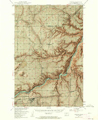
The Missouri River carves a deep course through this landscape at the dawn of the postwar era, marked by significant hydroelectric and industrial infrastructure. The presence of Morony Dam and Rainbow Dam downstream from the northeastern edge of Great Falls underscores the river's role in powering the region's growth. To the southwest, the Great Falls Army Air Force Base reflects the military footprint following the second World War, while the State Fish Hatchery and State Deaf & Dumb School point to established public institutions. Small agrarian settlements and siding stops like Portage, Salem, and Floweree are connected by the Great Northern and Chicago Milwaukee St Paul and Pacific railroads. The map also captures several local education centers including Roosevelt Sch and Salem Sch, serving the surrounding ranchlands.
Find a feature on this map
29 named features on this map. Tap any name to fly to it.
Don’t see what you’re looking for? This feature index may not catch every label — zoom into the map to look around manually.
Map Details
Editions of this 1948 Portage Map
4 editions found
Other maps of this area

1886 · Great Falls
USGS Topo · 1:250,000

1890 · Fort Benton
USGS Topo · 1:250,000

1892 · Fort Benton
USGS Topo · 1:250,000

1897 · Fort Benton
USGS Topo · 1:250,000

1949 · Portage
USGS Topo · 1:62,500

1949 · Timber Coulee
USGS Topo · 1:62,500

1949 · Great Falls
USGS Topo · 1:62,500

1950 · Timber Coulee
USGS Topo · 1:62,500

1950 · Dent Bridge
USGS Topo · 1:62,500

1951 · Great Falls
USGS Topo · 1:62,500