Loading...
Loading map...1951 Map of Great Falls
USGS Topo · Published 1951About this map
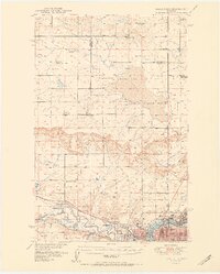
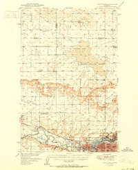
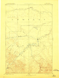
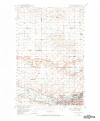
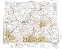
Great Falls serves as the industrial and civic heart of this mid-century landscape, positioned where the Sun River meets the Missouri River. The urban core is detailed with numerous institutional landmarks, including the Ursuline Academy, Deaconess Hospital Sch, and several neighborhood schools like McKinley Sch and Franklin Sch. Industrial activity is centered near Black Eagle and the Oil Refinery, while the surrounding plains reflect a transition to expansive conservation and agriculture.
Find a feature on this map
38 named features on this map. Tap any name to fly to it.
Don’t see what you’re looking for? This feature index may not catch every label — zoom into the map to look around manually.
Map Details
Date Portrayed1951
Date Published1951
PublisherU.S. Geological Survey
Map TypeTopographic
Scale1:62,500
Physical Dimensions17.11 x 21.28 inches
Editions of this 1951 Great Falls Map
2 editions found
Historical Maps of Great Falls Through Time
5 maps found

Featured Locations
Source Details
SourceU.S. Geological Survey
CopyrightPublic Domain