
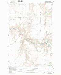
1954 Map of Waltham
USGS Topo · Published 1956About this map
The winding course of Belt Creek carves a deep valley through the high plains of north-central Montana, crossing the boundary between Chouteau and Cascade Counties. The 1950s landscape is defined by the engineering of the Chicago Milwaukee St Paul and Pacific railroad, which follows the river's serpentine bends through a series of numbered tunnels, including Amphitheater Tunnel No 4 and Belt Creek Tunnel No 5.
Find a feature on this map
22 named features on this map. Tap any name to fly to it.
Don’t see what you’re looking for? This feature index may not catch every label — zoom into the map to look around manually.
Map Details
Editions of this 1954 Waltham Map
2 editions found
Other maps of this area

1886 · Great Falls
USGS Topo · 1:250,000

1890 · Fort Benton
USGS Topo · 1:250,000

1892 · Fort Benton
USGS Topo · 1:250,000

1897 · Fort Benton
USGS Topo · 1:250,000

1948 · Portage
USGS Topo · 1:62,500

1949 · Portage
USGS Topo · 1:62,500

1954 · Great Falls
USGS Topo · 1:250,000

1954 · Rice Reservoir
USGS Topo · 1:24,000

1954 · Lander Crossing
USGS Topo · 1:24,000

1955 · Stockett
USGS Topo · 1:62,500