
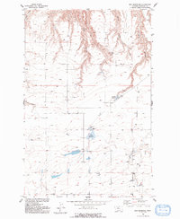
1954 Map of Rice Reservoir
USGS Topo · Published 1955About this map
Rice Reservoir and Birkeland Reservoir anchor the landscape of this Chouteau County ranching and water-management district during the mid-1950s. The map illustrates a high-plains terrain defined by the dendritic drainage patterns of Cherry Coulee, Long Coulee, and Short Coulee, which cut through the northern half of the survey area. These coulees represent the critical natural irrigation and drainage systems that shaped the development of the Missouri River Basin.
Find a feature on this map
10 named features on this map. Tap any name to fly to it.
Don’t see what you’re looking for? This feature index may not catch every label — zoom into the map to look around manually.
Map Details
Editions of this 1954 Rice Reservoir Map
2 editions found
Other maps of this area

1890 · Fort Benton
USGS Topo · 1:250,000

1892 · Fort Benton
USGS Topo · 1:250,000

1897 · Fort Benton
USGS Topo · 1:250,000

1953 · Carter
USGS Topo · 1:24,000

1953 · Tunis
USGS Topo · 1:24,000

1954 · Great Falls
USGS Topo · 1:250,000

1954 · Fort Benton
USGS Topo · 1:24,000

1954 · Lander Crossing
USGS Topo · 1:24,000

1954 · Waltham
USGS Topo · 1:24,000

1956 · Highwood
USGS Topo · 1:62,500