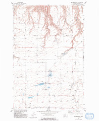
1954 Map of Rice Reservoir
USGS Topo · Published 1993About this map
Rice Reservoir and its associated water management infrastructure anchor this mid-century survey of the high plains in Chouteau County. The landscape is defined by a series of dramatic erosional features, including Bird Coulee, Cherry Coulee, and the aptly named Long Coulee and Short Coulee. These deep natural drainages cut through the level terrain, revealing the complex topography of a region reliant on strategic water storage. The presence of Birkeland Reservoir and a designated Spring further illustrates the critical role of water resources for agricultural and ranching sustainability in this environment. Surveyed during the 1950s, the map documents the precise elevation benchmarks and engineering details like the Spillway 3350 that shaped the local hydrology before modern developments altered the rural landscape.
Find a feature on this map
11 named features on this map. Tap any name to fly to it.
Don’t see what you’re looking for? This feature index may not catch every label — zoom into the map to look around manually.
Map Details
Editions of this 1954 Rice Reservoir Map
2 editions found
Other maps of this area

1890 · Fort Benton
USGS Topo · 1:250,000

1892 · Fort Benton
USGS Topo · 1:250,000

1897 · Fort Benton
USGS Topo · 1:250,000

1953 · Carter
USGS Topo · 1:24,000

1953 · Tunis
USGS Topo · 1:24,000

1954 · Great Falls
USGS Topo · 1:250,000

1954 · Rice Reservoir
USGS Topo · 1:24,000

1954 · Fort Benton
USGS Topo · 1:24,000

1954 · Lander Crossing
USGS Topo · 1:24,000

1954 · Waltham
USGS Topo · 1:24,000