
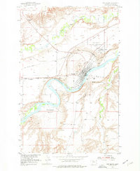
1954 Map of Fort Benton
USGS Topo · Published 1956About this map
Fort Benton sits at a strategic bend in the Missouri River, where the landscape transitions from the broad Cottonwood Bottom to the rising bluffs of The Canyon. This 1950s survey documents the town's infrastructure, including the Great Northern railway, the Fort Benton Municipal Airport, and several historical burial grounds such as Riverside Cem and the Pauper Cem. To the north, an Old Railroad Grade and the Fort Benton Military Reservation (Abandoned) suggest earlier phases of transportation and defense.
Find a feature on this map
25 named features on this map. Tap any name to fly to it.
Don’t see what you’re looking for? This feature index may not catch every label — zoom into the map to look around manually.
Map Details
Editions of this 1954 Fort Benton Map
2 editions found
Other maps of this area

1890 · Fort Benton
USGS Topo · 1:250,000

1892 · Fort Benton
USGS Topo · 1:250,000

1897 · Fort Benton
USGS Topo · 1:250,000

1953 · Tunis
USGS Topo · 1:24,000

1953 · O'Hanlon Coulee
USGS Topo · 1:24,000

1953 · Loma West
USGS Topo · 1:24,000

1954 · Great Falls
USGS Topo · 1:250,000

1954 · Rice Reservoir
USGS Topo · 1:24,000

1956 · Highwood
USGS Topo · 1:62,500

1957 · Great Falls
USGS Topo · 1:250,000