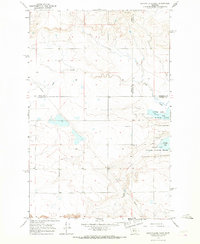
1965 Map of Benton Lake West
USGS Topo · Published 1967About this map
Benton Lake National Wildlife Refuge dominates the eastern landscape of this 1960s survey, showing a complex of wetlands and water bodies like the central Benton Lake. The terrain is defined by low-lying basins and the intersection of three Montana counties — Teton, Cascade, and Chouteau. Man-made interventions in this prairie environment are marked by a long Pipeline cutting diagonally across the northwestern and southeastern corners, alongside isolated features such as a Well and a Gravel Pit. The map reveals a transition between managed wildlife habitats and the surrounding open rangeland, characterized by subtle depressions and seasonal drainages typical of the northern Great Plains before significant modern development altered the local water management patterns.
Find a feature on this map
10 named features on this map. Tap any name to fly to it.
Don’t see what you’re looking for? This feature index may not catch every label — zoom into the map to look around manually.
Map Details
Editions of this 1965 Benton Lake West Map
2 editions found
Other maps of this area

1886 · Great Falls
USGS Topo · 1:250,000

1949 · Timber Coulee
USGS Topo · 1:62,500

1949 · Great Falls
USGS Topo · 1:62,500

1949 · Vaughn
USGS Topo · 1:62,500

1950 · Timber Coulee
USGS Topo · 1:62,500

1950 · Dutton
USGS Topo · 1:62,500

1951 · Great Falls
USGS Topo · 1:62,500

1952 · Vaughn
USGS Topo · 1:62,500

1954 · Great Falls
USGS Topo · 1:250,000

1957 · Great Falls
USGS Topo · 1:250,000