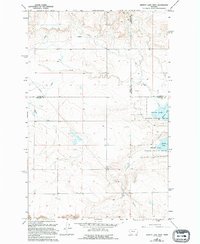
1965 Map of Benton Lake West
USGS Topo · Published 1994About this map
Benton Lake National Wildlife Refuge dominates the eastern landscape of this high plains region, where the prairie meets the expansive wetlands of Benton Lake. The terrain is characterized by a network of drainage and water management, featuring a prominent Aqueduct and Pipeline system that cuts across the land. These features, along with Lake Creek, highlight the vital importance of water control in this arid Montana environment. The map also records the jurisdictional tri-point where the boundaries of Teton, Cascade, and Chouteau counties converge. While primarily a natural landscape, the presence of a Gravel Pit indicates localized resource extraction amidst the vast open sections of the northern plains.
Find a feature on this map
9 named features on this map. Tap any name to fly to it.
Don’t see what you’re looking for? This feature index may not catch every label — zoom into the map to look around manually.
Map Details
Editions of this 1965 Benton Lake West Map
2 editions found
Other maps of this area

1886 · Great Falls
USGS Topo · 1:250,000

1949 · Timber Coulee
USGS Topo · 1:62,500

1949 · Great Falls
USGS Topo · 1:62,500

1949 · Vaughn
USGS Topo · 1:62,500

1950 · Timber Coulee
USGS Topo · 1:62,500

1950 · Dutton
USGS Topo · 1:62,500

1951 · Great Falls
USGS Topo · 1:62,500

1952 · Vaughn
USGS Topo · 1:62,500

1954 · Great Falls
USGS Topo · 1:250,000

1957 · Great Falls
USGS Topo · 1:250,000