1980s Maps of Chouteau County, Montana
Explore 27 historic maps of Chouteau County from the 1980s. These maps offer a rare glimpse into what life looked like during the 1980s — showing old roads, neighborhoods, homes, and landmarks that have changed or disappeared over time.
Whether you're researching your family's past, planning a metal detecting trip, or studying how Chouteau County's landscape evolved across the 1980s, these high-resolution maps are a powerful tool for exploring the history of this region.
- Focus on a specific era: All maps on this page are from the 1980s, giving you a focused view of this time period.
- See what’s changed: Compare century-old streets, trails, and buildings to today's modern landscape using overlays and satellite layers.
- Research with precision: Use these maps for genealogy, historical research, land use analysis, or educational projects.
- View, download, or print: Maps are fully viewable online in high resolution, and can be downloaded or printed for your own records.
Start exploring Chouteau County's history through authentic maps from the 1980s. This is your window into the past.
Chouteau County, MT maps
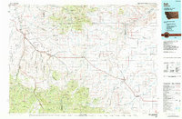
(27)- 1982 Map of Highwood, 1983 Print
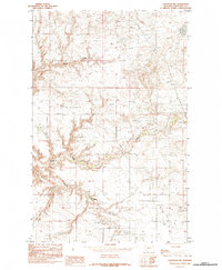
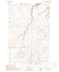
 1982 Highwood1983 Print · USGSHighwood and the surrounding grain country are captured here in the early eighties, showing a landscape shaped by agricultural logistics and deep coulees. Trace the Old Railroad Grade past Highwood or locate the rural Cem near North Willow Creek.
 - 1982 Map of Belt NE, 1983 Print
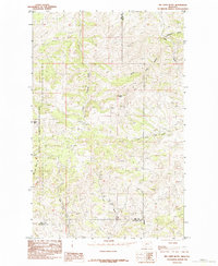
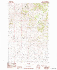
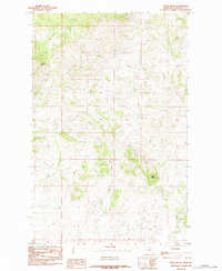
 1982 Belt NE1983 Print · USGSThe Montana ranchlands of the early eighties are mapped here along the border of Cascade and Chouteau counties. Researchers can trace rural landmarks and old watercourses like Willow Bend School, Willow Creek Ranch, and Big Willow Creek.
 - 1984 Map of Conrad
 1984 Conrad1984 Print · USGSNorth-central Montana's high plains and river valleys come to life in this mid-eighties record of Pondera and Toole counties. Genealogists and historians can trace rail-stop towns along the Burlington Northern or locate rural landmarks like Favot and Alkali Springs.
 - 1984 Map of Fort Benton
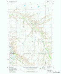
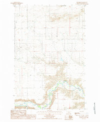
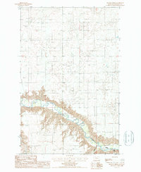
 1984 Fort Benton1984 Print · USGSMid-century Montana life revolves around the river forks and rail lines in the years following the designation of the Wild and Scenic River. You can trace the Burlington Northern lines through Fort Benton, locate the Loma Ferry, and identify high points like Highwood Baldy or Square Butte.
 - 1984 Map of Lonesome Lake
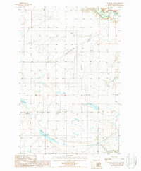
 1984 Lonesome Lake1984 Print · USGSNorth-central Montana at the dawn of the 1980s reveals a landscape of high plains and deep coulees. Genealogists and historians can trace the Burlington Northern rail line through Big Sandy, Verona, and the Rocky Boys Indian Reservation.
 - 1984 Map of Eskay NE
 1984 Eskay NE1984 Print · USGSNorth Central Montana's high-country terrain is captured here in the mid-1980s, tracing the boundary between Chouteau and Blaine counties. Researchers can locate distinctive landmarks like Blue Stone Peak, Tiger Butte, and the drainage of Sand Creek.
 - 1984 Map of Belt
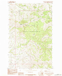
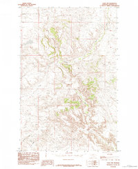
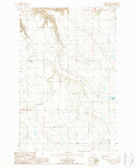
 1984 Belt1984 Print · USGSCentral Montana's high peaks and ranching benches are captured here in the early 1980s, documenting the region's mining and rail heritage. Genealogists and historians can locate remote mining outposts like Hughesville and Barker, or trace the Burlington Northern Railroad through Belt and Stanford.
 - 1984 Map of Big John Butte
 1984 Big John Butte1984 Print · USGSNorth-central Montana territory at the edge of the Bear Paw Mountains is captured here in the mid-1980s. Researchers can trace the borders of the Rocky Boy Indian Reservation and locate landmarks like Big John Butte and Moses Mtn.
 - 1984 Map of Warrick
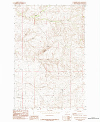
 1984 Warrick1984 Print · USGSNorth-Central Montana in the mid-1980s was defined by its cattle-country topography and vital water sources. Researchers can trace land use through named landmarks like Rattlesnake Butte and reliable water points such as Polish Spring and Gasparage Spring.
 - 1984 Map of Bowery Peak
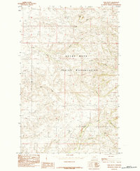
 1984 Bowery Peak1984 Print · USGSNorth-central Montana’s high-country peaks and reservation lands are captured here in the mid-1980s. Researchers can trace the cultural and physical geography of the Rocky Boys Indian Reservation, identifying landmarks like Bowery Peak, Baldy Mountain, and Amisk Pond.
 - 1984 Map of Centennial Mountain
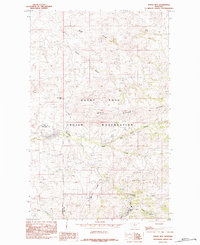
 1984 Centennial Mountain1984 Print · USGSThe northern Montana high country comes into focus in the mid-1980s, centered on the Rocky Boys Indian Reservation. Researchers can trace intricate seasonal drainages like Oosahquapahmoo Creek and Mistiguenou Creek or locate landmarks such as Centennial Mountain.
 - 1984 Map of Cowan Reservoir
 1984 Cowan Reservoir1984 Print · USGSThe northern Montana plains meet the reservation highlands in the late seventies and early eighties. Researchers can trace the varied water resources of the Hill Co border, from Cowan Reservoir to the prominent heights of Square Butte.
 - 1984 Map of Seifort Reservoir
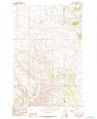
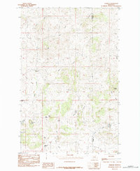
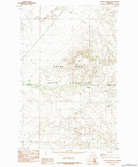
 1984 Seifort Reservoir1984 Print · USGSThe Montana high plains of Chouteau County come into focus during the mid-eighties, showing a landscape defined by ranching infrastructure and water management. Researchers can locate specific Grain Bins and trace the winding courses of Eagle Creek and Seifort Reservoir.
 - 1984 Map of Studhorse Butte
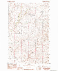
 1984 Studhorse Butte1984 Print · USGSChouteau County in the mid-1980s reveals a vast landscape of high-plains ranch land and seasonal watercourses. Genealogists and land researchers can trace property boundaries and landmarks like Studhorse Butte, Rattlesnake Butte, and Godfrey Creek.
 - 1984 Map of Eskay NW
 1984 Eskay NW1984 Print · USGSThe Chouteau County plains of the mid-1980s are preserved in this detailed topographic study of the region's complex drainage systems. Researchers can trace the winding course of Birch Creek and identify landmarks like West Ridge and the deep cuts of Sandstone Coulee.
 - 1984 Map of Ryan Butte
 1984 Ryan Butte1984 Print · USGSChouteau County's rugged ranching country is documented here in the mid-1980s, showcasing a landscape of high buttes and winding creeks. You can trace the drainages of Eagle Creek and Little Sandy Creek or locate landmarks like Ryan Butte and Mc Namara Butte.
 - 1984 Map of Table Butte
 1984 Table Butte1984 Print · USGSThe Bearpaw Mountains and the Rocky Boys Indian Reservation are captured here in the early eighties. Researchers can locate isolated landmarks like the Coal Mine near Coal Mine Coulee or trace the watercourses of Big Sandy Creek.
 - 1984 Map of Rocky Boy
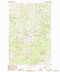
 1984 Rocky Boy1984 Print · USGSThe Bear Paw Mountains foothills come into focus in the mid-1980s, centered on the ROCKY BOYS INDIAN RESERVATION. Researchers can trace the settlement of Rocky Boy and family-named landmarks like Gardipee Hill and Pasquowmustus Ridge.
 - 1984 Map of Eagleton NW
 1984 Eagleton NW1984 Print · USGSChouteau County's high plains are mapped in the mid-1980s, showing a landscape defined by sharp buttes and deep coulees. Researchers can locate specific ranching infrastructure and landmarks like Iliad, Eagle Buttes, and the Seifort Reservoir.
 - 1984 Map of Tiger Butte
 1984 Tiger Butte1984 Print · USGSChouteau County's rugged breaks and butte country are captured in this mid-eighties survey. Researchers can trace the elevation changes and drainage patterns along Tiger Butte, Dog Creek, and Sawmill Butte.
 - 1987 Map of Dent Bridge
 1987 Dent Bridge1987 Print · USGSChouteau County in the late 1980s reveals a quiet ranching landscape defined by the winding Teton River. Researchers can locate key river crossings like Dent Bridge and natural landmarks such as Hay Stack Butte and local Gravel Pit sites.
 - 1987 Map of Antelope Lake
 1987 Antelope Lake1987 Print · USGSThe high plains of Chouteau County come into focus during the late 1980s, showcasing a landscape of section lines and deep prairie drainages. Researchers can trace the winding paths of Weatherwax Coulee and Antelope Coulee or locate the seasonal waters of Antelope Lake.
 - 1987 Map of Timber Coulee South
 1987 Timber Coulee South1987 Print · USGSThe high plains of the Teton and Chouteau county border are captured here in the late eighties. Researchers can trace the industrial landscape of the era via the Landing Strip, the Pumping Station, and the Rd on Causeway.
 - 1987 Map of Shannon Bridge
 1987 Shannon Bridge1987 Print · USGSNorth Central Montana's riverbreaks come into focus in the late 1980s, documenting a landscape of isolated schools and river crossings. Genealogists and historians can trace Faris School, the Woods Crossing site, and family-named landmarks like Mc Bridy Spring.
 - 1987 Map of Antelope Flat
 1987 Antelope Flat1987 Print · USGSThe high plains of Chouteau County come into focus during the late eighties, showing a landscape defined by seasonal water and land management. Researchers can trace the drainages of Berry Coulee or locate regional water sources like Antelope Lake and Sheep Coulee Springs.
Showing maps 1-25 of 27
Top cities of Chouteau County
Frequently asked questions
- What are the different types of historical maps available for Chouteau County?
- What is the oldest map of Chouteau County?
- Where can I purchase historical maps of Chouteau County for my home or office?
- Where can I download high-res historical maps of Chouteau County?
- Are there historical topographic maps available for Chouteau County?
- Is there historical aerial imagery available for Chouteau County?
- Where are historical maps of Chouteau County sourced from?