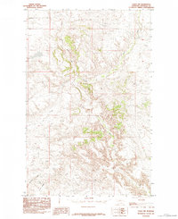
1984 Map of Eskay NW
USGS Topo · Published 1984About this map
Birch Creek winds through the heart of this landscape in Chouteau County, carving deep drainage patterns through a series of dramatic coulees and high plains. Compiled from mid-1970s aerial photography, this provisional record illustrates the intricate natural topography of the Montana plains before the digital mapping era. To the southwest, the prominent elevation of West Ridge overlooks the junction of several seasonal waterways, including the winding path of Chip Creek. The drainage of Sandstone Coulee further defines the southwestern corner of the sheet, highlighting the erosion-shaped terrain that characterizes this ranching and agricultural region. While the area is largely devoid of dense settlements, the placement of specific coulees and ridges provides essential landmarks for those tracing historical land use or topographic changes in the Missouri River watershed.
Find a feature on this map
4 named features on this map. Tap any name to fly to it.
Don’t see what you’re looking for? This feature index may not catch every label — zoom into the map to look around manually.
Map Details
Editions of this 1984 Eskay NW Map
This is the sole edition of this map. No revisions or reprints were ever made.
Other maps of this area

1953 · Havre
USGS Topo · 1:250,000

1954 · Iliad
USGS Topo · 1:24,000

1954 · Lewistown
USGS Topo · 1:250,000

1957 · Havre
USGS Topo · 1:250,000

1958 · Havre
USGS Topo · 1:250,000

1959 · Lewistown
USGS Topo · 1:250,000

1959 · Warrick
USGS Topo · 1:62,500

1959 · Centennial Mountain
USGS Topo · 1:62,500

1964 · Pigtail Coulee
USGS Topo · 1:24,000

1964 · Chase Hill
USGS Topo · 1:24,000