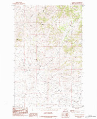
1984 Map of Ryan Butte
USGS Topo · Published 1984About this map
Ryan Butte rises above the drainage networks of Chouteau County in this mid-1980s landscape, characterized by the intricate headwaters and coulees of the Missouri River basin. The terrain is defined by prominent topographical markers such as Flying A Butte and Mc Namara Butte, which likely served as critical orientation points for early ranching and surveying in this portion of Montana. The map documents a complex system of seasonal and perennial waterways, including the winding course of Eagle Creek and its tributary, Little Eagle Creek. These drainages, alongside Little Sandy Creek and Godfrey Creek, illustrate the natural erosion patterns and land use boundaries of the region. The inclusion of Salt Coulee and Dog Creek further highlights the hydraulic character of the plains, where small elevation changes and water access historically dictated the location of homesteads and grazing lands.
Find a feature on this map
10 named features on this map. Tap any name to fly to it.
Don’t see what you’re looking for? This feature index may not catch every label — zoom into the map to look around manually.
Map Details
Editions of this 1984 Ryan Butte Map
This is the sole edition of this map. No revisions or reprints were ever made.
Other maps of this area

1953 · Havre
USGS Topo · 1:250,000

1954 · Lewistown
USGS Topo · 1:250,000

1957 · Havre
USGS Topo · 1:250,000

1958 · Havre
USGS Topo · 1:250,000

1959 · Lewistown
USGS Topo · 1:250,000

1959 · Warrick
USGS Topo · 1:62,500

1959 · Centennial Mountain
USGS Topo · 1:62,500
1984 · Bowery Peak
USGS Topo · 1:24,000
1984 · Centennial Mountain
USGS Topo · 1:24,000
1984 · Seifort Reservoir
USGS Topo · 1:24,000