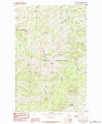
1984 Map of Bowery Peak
USGS Topo · Published 1984About this map
The Rocky Boys Indian Reservation dominates this mid-1980s landscape, encompassing a high-relief terrain of ridges and peaks along the border of Hill and Chouteau counties. Central to the map is the namesake Bowery Peak, surrounded by family-named landmarks and peaks like Long George Peak, Bailey Peak, and Little Joe Peak. The drainage patterns are intricate, with Boxelder Creek and Beaver Creek carving through the highlands, supplemented by seasonal waters such as Alkali Springs and Amisk Pond.
Find a feature on this map
38 named features on this map. Tap any name to fly to it.
Don’t see what you’re looking for? This feature index may not catch every label — zoom into the map to look around manually.
Map Details
Editions of this 1984 Bowery Peak Map
This is the sole edition of this map. No revisions or reprints were ever made.
Other maps of this area

1953 · Havre
USGS Topo · 1:250,000

1957 · Havre
USGS Topo · 1:250,000

1958 · Havre
USGS Topo · 1:250,000

1959 · Warrick
USGS Topo · 1:62,500

1959 · Laredo
USGS Topo · 1:62,500

1959 · Centennial Mountain
USGS Topo · 1:62,500

1959 · Shambo
USGS Topo · 1:62,500
1984 · Bearpaw Lake
USGS Topo · 1:24,000

1984 · Big John Butte
USGS Topo · 1:24,000
1984 · Shambo SE
USGS Topo · 1:24,000