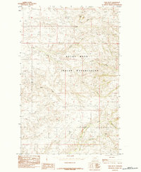
1984 Map of Table Butte
USGS Topo · Published 1984About this map
The Rocky Boys Indian Reservation dominates the center of this Montana landscape, covering the northern reaches of the Bearpaw Mountains. Topography here is defined by deep drainages and high points like Table Butte, where the North Fork Gorman Creek and South Fork Gorman Creek converge. The survey reveals a sparse but functional infrastructure of the late twentieth century, including a remote Coal Mine situated near the head of Coal Mine Coulee and scattered Grain Bins that speak to the region's agricultural use. To the south, the terrain levels out toward the winding paths of Big Sandy Creek and Frenchman Creek, illustrating the transition from upland ridges to the broader plains of Chouteau County.
Find a feature on this map
13 named features on this map. Tap any name to fly to it.
Don’t see what you’re looking for? This feature index may not catch every label — zoom into the map to look around manually.
Map Details
Editions of this 1984 Table Butte Map
This is the sole edition of this map. No revisions or reprints were ever made.
Other maps of this area

1904 · Boxelder
USGS Topo · 1:62,500

1906 · Boxelder
USGS Topo · 1:62,500

1919 · Big Sandy
USGS Topo · 1:125,000

1953 · Lonetree Coulee
USGS Topo · 1:24,000

1953 · Havre
USGS Topo · 1:250,000

1954 · Shelby
USGS Topo · 1:250,000

1957 · Havre
USGS Topo · 1:250,000

1958 · Shelby
USGS Topo · 1:250,000

1958 · Havre
USGS Topo · 1:250,000

1959 · Laredo
USGS Topo · 1:62,500