
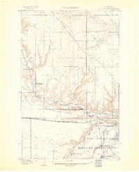
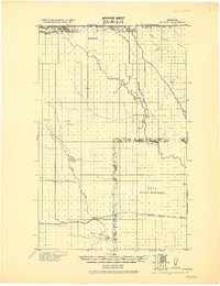
1904 Map of Boxelder
USGS Topo · Published 1959About this map
Boxelder serves as a primary point of interest on this North-Central Montana landscape, which was surveyed at the dawn of the 20th century. The settlement patterns shown here emphasize a ranching economy, with several family-named homesteads such as Faulkner's Ranch and Schwartz's Ranch established near essential water sources. The Great Northern R R cuts through the eastern portion of the quadrangle, paralleling Big Sandy Creek and providing a vital link for the remote livestock operations in Chouteau County.
Find a feature on this map
23 named features on this map. Tap any name to fly to it.
Don’t see what you’re looking for? This feature index may not catch every label — zoom into the map to look around manually.
Map Details
Editions of this 1904 Boxelder Map
This is the sole edition of this map. No revisions or reprints were ever made.
Other maps of this area
1904 · Assinniboine
USGS Topo · 1:62,500
1906 · Kremlin
USGS Topo · 1:62,500
1906 · Lonesome
USGS Topo · 1:62,500

1906 · Boxelder
USGS Topo · 1:62,500

1912 · Thibedeau Lake
USGS Topo · 1:125,000
1919 · Big Sandy
USGS Topo · 1:125,000
1920 · Gildford
USGS Topo · 1:125,000
1943 · Gildford
USGS Topo · 1:125,000

1953 · Havre
USGS Topo · 1:250,000

1954 · Shelby
USGS Topo · 1:250,000