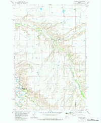
1982 Map of Highwood
USGS Topo · Published 1983About this map
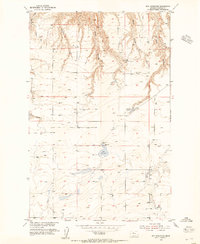
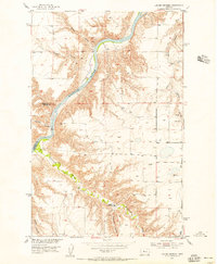
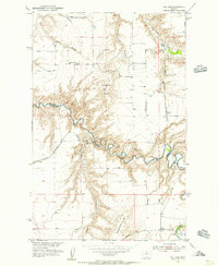
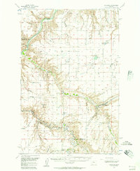
Highwood serves as the central hub of this agricultural landscape, situated at the confluence of several prominent geographic features. The terrain is defined by the carved paths of Highwood Creek and Big Sag, where the flat prairie gives way to significant coulees like Deadman Coulee and Indian Coulee. Evidence of the area's logistical history is visible in the Old Railroad Grade that winds through the hills north of town, tracing a path toward the grain infrastructure marked by numerous Storage Bins scattered across the township lines. The southern portion of the map transitions toward the valley of Belt Creek, where the boundary between Chouteau and Cascade counties is clearly delineated. Local landmarks such as the Cemetery near the southern border and the Athletic Fields and Park in town provide specific points of interest for genealogists and local historians tracking the development of this rural community in the early 1980s.
Find a feature on this map
18 named features on this map. Tap any name to fly to it.
Don’t see what you’re looking for? This feature index may not catch every label — zoom into the map to look around manually.
Map Details
Editions of this 1982 Highwood Map
This is the sole edition of this map. No revisions or reprints were ever made.
Other maps of this area

1890 · Fort Benton
USGS Topo · 1:250,000

1892 · Fort Benton
USGS Topo · 1:250,000

1897 · Fort Benton
USGS Topo · 1:250,000

1954 · Great Falls
USGS Topo · 1:250,000
1954 · Rice Reservoir
USGS Topo · 1:24,000
1954 · Lander Crossing
USGS Topo · 1:24,000
1954 · Waltham
USGS Topo · 1:24,000
1956 · Highwood
USGS Topo · 1:62,500
1956 · Belt
USGS Topo · 1:62,500

1957 · Great Falls
USGS Topo · 1:250,000