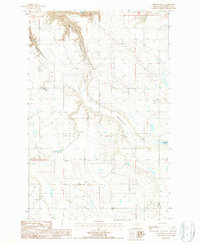
1987 Map of Antelope Flat
USGS Topo · Published 1987About this map
Berry Coulee and the surrounding high plains of Chouteau County define this landscape, where natural drainage and seasonal water sources dictate the placement of human activity. The terrain is characterized by broad expanses like Leepers Flat and Antelope Flat, which transitions into the localized depression of Antelope Lake. These features reflect a classic high-plains environment where water is a precious resource, underscored by the presence of Sheep Coulee Springs. This 1987 provisional study reveals a rural economy primarily focused on resource extraction and water management. Small-scale industrial activity is evidenced by a Gravel Pit and scattered Well sites, indicating the sparse but deliberate infrastructure required to support the remote ranching or agricultural operations of the region. The map provides a look at the section lines and township boundaries that organized the territory into a functional grid for development and land ownership.
Find a feature on this map
14 named features on this map. Tap any name to fly to it.
Don’t see what you’re looking for? This feature index may not catch every label — zoom into the map to look around manually.
Map Details
Editions of this 1987 Antelope Flat Map
This is the sole edition of this map. No revisions or reprints were ever made.
Other maps of this area

1886 · Great Falls
USGS Topo · 1:250,000

1948 · Portage
USGS Topo · 1:62,500

1949 · Portage
USGS Topo · 1:62,500

1949 · Timber Coulee
USGS Topo · 1:62,500

1949 · Great Falls
USGS Topo · 1:62,500

1950 · Timber Coulee
USGS Topo · 1:62,500

1950 · Dent Bridge
USGS Topo · 1:62,500

1951 · Great Falls
USGS Topo · 1:62,500

1954 · Great Falls
USGS Topo · 1:250,000

1957 · Great Falls
USGS Topo · 1:250,000