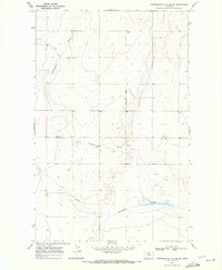
1969 Map of Fourteenmile Coulee SE
USGS Topo · Published 1972About this map
The county line between Hill Co and Chouteau Co bisects this northern Montana landscape, revealing a high-plains terrain defined by drainage patterns and seasonal watercourses. The 1969 field check documents an agricultural and industrial footprint where Storage Bins and scattered Gravel Pits suggest a localized economy of grain storage and road material extraction. The topography is deeply etched by a series of significant coulees, most notably Fourteenmile Coulee, which snakes across the central portion of the sheet. Further south, the map traces the paths of Sixmile Coulee and Twelvemile Coulee. These features represent the critical drainage infrastructure of the region, where the land rises toward benches between the water-carved depressions. The mapping detail focuses on these natural contours and the utilitarian structures required for prairie life during the late 1960s.
Find a feature on this map
7 named features on this map. Tap any name to fly to it.
Don’t see what you’re looking for? This feature index may not catch every label — zoom into the map to look around manually.
Map Details
Editions of this 1969 Fourteenmile Coulee SE Map
This is the sole edition of this map. No revisions or reprints were ever made.
Other maps of this area

1904 · Boxelder
USGS Topo · 1:62,500

1906 · Lonesome
USGS Topo · 1:62,500

1906 · Boxelder
USGS Topo · 1:62,500

1919 · Big Sandy
USGS Topo · 1:125,000

1954 · Shelby
USGS Topo · 1:250,000

1958 · Shelby
USGS Topo · 1:250,000

1969 · Box Elder NW
USGS Topo · 1:24,000

1969 · Fourteenmile Coulee SW
USGS Topo · 1:24,000
1969 · Lonesome Lake
USGS Topo · 1:24,000

1969 · Fourteenmile Coulee NW
USGS Topo · 1:24,000