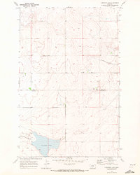
1969 Map of Lonesome Lake
USGS Topo · Published 1972About this map
Lonesome Lake anchors the southern portion of this high-plains landscape, where the geography is defined by seasonal water drainage and the subtle shifts in the North Central Montana prairie. The map depicts the transition between Hill and Chouteau counties, a boundary that runs through a region marked by extensive coulees like Twelvemile Coulee and Barneys Coulee. These features represent the natural erosion patterns typical of this semi-arid environment.
Find a feature on this map
8 named features on this map. Tap any name to fly to it.
Don’t see what you’re looking for? This feature index may not catch every label — zoom into the map to look around manually.
Map Details
Editions of this 1969 Lonesome Lake Map
This is the sole edition of this map. No revisions or reprints were ever made.
Other maps of this area

1904 · Boxelder
USGS Topo · 1:62,500

1906 · Lonesome
USGS Topo · 1:62,500

1906 · Boxelder
USGS Topo · 1:62,500

1919 · Big Sandy
USGS Topo · 1:125,000

1954 · Shelby
USGS Topo · 1:250,000

1958 · Shelby
USGS Topo · 1:250,000

1969 · Box Elder NW
USGS Topo · 1:24,000
1969 · Big Sandy
USGS Topo · 1:24,000
1969 · Fourteenmile Coulee SE
USGS Topo · 1:24,000
1969 · Fourteenmile Coulee NE
USGS Topo · 1:24,000