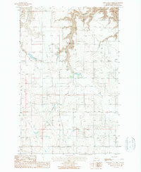
1965 Map of Sheep Coulee Spring
USGS Topo · Published 1987About this map
Sheep Coulee Spring sits at the heart of this high-plains landscape in Chouteau County, serving as a vital water source for the surrounding dry grasslands. The terrain is defined by deep, winding drainage patterns including Sheep Coulee and Wolf Coulee, which cut through the level benchland. These natural features dictated the early movement of livestock and travelers through this part of north-central Montana. By the 1960s, modern utility infrastructure arrived in the form of a major north-south Pipeline and an east-west Trans Line, marking the transition from a purely agricultural range to a corridor for regional energy and power transport. The map's detail reveals how these industrial lines negotiate the irregular topography of the coulees while bypassing the older, established water points.
Find a feature on this map
8 named features on this map. Tap any name to fly to it.
Don’t see what you’re looking for? This feature index may not catch every label — zoom into the map to look around manually.
Map Details
Editions of this 1965 Sheep Coulee Spring Map
This is the sole edition of this map. No revisions or reprints were ever made.
Other maps of this area

1886 · Great Falls
USGS Topo · 1:250,000

1948 · Portage
USGS Topo · 1:62,500

1949 · Portage
USGS Topo · 1:62,500

1949 · Timber Coulee
USGS Topo · 1:62,500

1949 · Great Falls
USGS Topo · 1:62,500

1950 · Timber Coulee
USGS Topo · 1:62,500

1950 · Dent Bridge
USGS Topo · 1:62,500

1951 · Great Falls
USGS Topo · 1:62,500

1954 · Great Falls
USGS Topo · 1:250,000

1957 · Great Falls
USGS Topo · 1:250,000