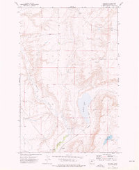
1972 Map of Shonkin
USGS Topo · Published 1976About this map
Shonkin and the smaller locality of Frenchie anchor this early 1970s topographic study of Chouteau County. The landscape is defined by the winding course of Shonkin Creek as it flows toward the expansive Shonkin Lake. The presence of the Chicago Milwaukee St Paul and Pacific railroad line running alongside the lake illustrates the vital transportation corridor used for moving agricultural goods through this part of Montana. Clusters of Storage Bins near the tracks further emphasize the area's role in the regional grain economy. To the southeast, Sand Lake and a nearby Gravel Pit highlight the localized natural resources and water features that shaped settlement patterns and land use in this high plains environment during the mid-20th century.
Find a feature on this map
8 named features on this map. Tap any name to fly to it.
Don’t see what you’re looking for? This feature index may not catch every label — zoom into the map to look around manually.
Map Details
Editions of this 1972 Shonkin Map
This is the sole edition of this map. No revisions or reprints were ever made.
Other maps of this area

1890 · Fort Benton
USGS Topo · 1:250,000

1892 · Fort Benton
USGS Topo · 1:250,000

1897 · Fort Benton
USGS Topo · 1:250,000

1953 · Rocky Lake
USGS Topo · 1:24,000

1953 · O'Hanlon Coulee
USGS Topo · 1:24,000

1954 · Great Falls
USGS Topo · 1:250,000

1954 · Fort Benton
USGS Topo · 1:24,000

1957 · Great Falls
USGS Topo · 1:250,000
1972 · Montague
USGS Topo · 1:24,000
1972 · Shonkin NW
USGS Topo · 1:24,000