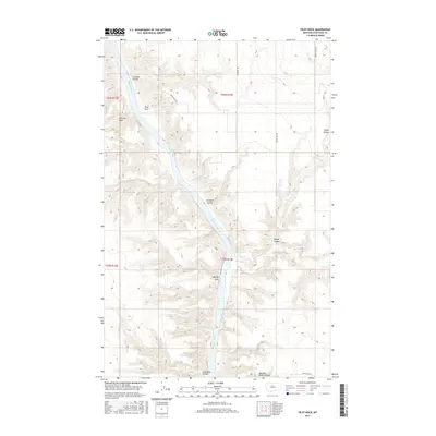
2017 Map of Pilot Rock
USGS Topo · Published 2017About this map
The Missouri River carves a dramatic path through this section of Chouteau County, creating a landscape defined by sharp breaks and significant geological formations. Prominent landmarks such as Pilot Rock, LaBarge Rock, and Fortress Rock stand as sentinels along the river corridor, which remains largely undeveloped except for a network of rural routes including White Rocks Rd and Lonetree Trl. This area is characterized by a complex system of drainages, where the river is fed by Eagle Cr and numerous coulees. The names given to these features, such as Coal Mine Coulee and Butcher Knife Canyon, hint at the area's physical history and the challenges of the terrain. The map captures the meeting point of several townships, showing the interplay between the winding waterway and the rigid grid of the Public Land Survey System.
Find a feature on this map
19 named features on this map. Tap any name to fly to it.
Don’t see what you’re looking for? This feature index may not catch every label — zoom into the map to look around manually.
Map Details
Editions of this 2017 Pilot Rock Map
This is the sole edition of this map. No revisions or reprints were ever made.
Other maps of this area

1890 · Fort Benton
USGS Topo · 1:250,000

1892 · Fort Benton
USGS Topo · 1:250,000

1897 · Fort Benton
USGS Topo · 1:250,000

1919 · Big Sandy
USGS Topo · 1:125,000

1953 · Eagle Buttes
USGS Topo · 1:24,000

1953 · Verona
USGS Topo · 1:24,000

1953 · Big Bend School
USGS Topo · 1:24,000

1953 · Lonetree Coulee
USGS Topo · 1:24,000

1953 · Pilot Rock
USGS Topo · 1:24,000

1953 · Havre
USGS Topo · 1:250,000