
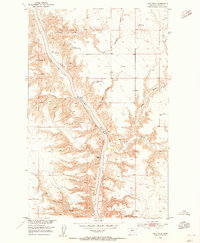
1953 Map of Pilot Rock
USGS Topo · Published 1955About this map
The Missouri River carves a deep path through Chouteau County in this mid-century survey, revealing a landscape defined by dramatic geological formations and early industrial attempts. Distinctive landmarks like Pilot Rock, Fortress Rock, and White Rocks serve as natural beacons along the river's winding course, while the southern reaches show the remnants of local extraction at the Coal Mine (Aband) near Coal Mine Coulee.
Find a feature on this map
11 named features on this map. Tap any name to fly to it.
Don’t see what you’re looking for? This feature index may not catch every label — zoom into the map to look around manually.
Map Details
Editions of this 1953 Pilot Rock Map
2 editions found
Other maps of this area

1890 · Fort Benton
USGS Topo · 1:250,000

1892 · Fort Benton
USGS Topo · 1:250,000

1897 · Fort Benton
USGS Topo · 1:250,000

1919 · Big Sandy
USGS Topo · 1:125,000

1953 · Eagle Buttes
USGS Topo · 1:24,000

1953 · Verona
USGS Topo · 1:24,000

1953 · Big Bend School
USGS Topo · 1:24,000

1953 · Lonetree Coulee
USGS Topo · 1:24,000

1953 · Havre
USGS Topo · 1:250,000

1954 · Great Falls
USGS Topo · 1:250,000