
1953 Map of Verona
USGS Topo · Published 1955About this map
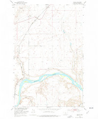
The Missouri River cuts a deep, winding path through this portion of Chouteau County, creating a landscape defined by sharp coulees and riverside flats. In the early 1950s, the river remained a central geographic feature, though the presence of the Great Northern railway and the Coal Banks Bridge highlights the shift toward land-based transportation networks. The map identifies the Coal Banks Landing (Site), a location that speaks to the era of river commerce before the rail dominated the plains.
Find a feature on this map
17 named features on this map. Tap any name to fly to it.
Don’t see what you’re looking for? This feature index may not catch every label — zoom into the map to look around manually.
Map Details
Editions of this 1953 Verona Map
2 editions found
Other maps of this area

1890 · Fort Benton
USGS Topo · 1:250,000

1892 · Fort Benton
USGS Topo · 1:250,000

1897 · Fort Benton
USGS Topo · 1:250,000

1906 · Lonesome
USGS Topo · 1:62,500

1919 · Big Sandy
USGS Topo · 1:125,000

1953 · Boggs Island
USGS Topo · 1:24,000

1953 · Big Bend School
USGS Topo · 1:24,000

1953 · Lonetree Coulee
USGS Topo · 1:24,000

1953 · Pilot Rock
USGS Topo · 1:24,000

1953 · Stranahan
USGS Topo · 1:24,000