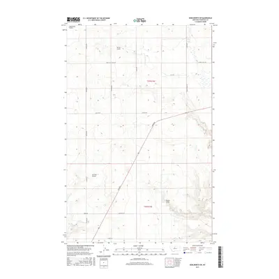
2017 Map of Kenilworth SW
USGS Topo · Published 2017About this map
The high plains of Chouteau County are defined by a network of drainage features and straight-line section roads that reflect the systematic layout of the Public Land Survey System. Major geographical markers include Twelvemile Coulee in the north and the deep channel of Dry Fork Coulee to the west, with Sixmile Coulee cutting through the southeastern corner. This landscape is partitioned by a grid of named local thoroughfares, such as Rudyard Rd and Houston Rd, which provide access to the dryland farming operations characteristic of this region. The route known as Broadway cuts diagonally across the section lines, suggesting a historic transportation path that deviates from the rigid township and range grid of t27n r10e and t26n r10e.
Find a feature on this map
18 named features on this map. Tap any name to fly to it.
Don’t see what you’re looking for? This feature index may not catch every label — zoom into the map to look around manually.
Map Details
Editions of this 2017 Kenilworth SW Map
This is the sole edition of this map. No revisions or reprints were ever made.
Other maps of this area

1890 · Fort Benton
USGS Topo · 1:250,000

1892 · Fort Benton
USGS Topo · 1:250,000

1897 · Fort Benton
USGS Topo · 1:250,000

1906 · Lonesome
USGS Topo · 1:62,500

1919 · Big Sandy
USGS Topo · 1:125,000

1953 · Boggs Island
USGS Topo · 1:24,000

1953 · Loma East
USGS Topo · 1:24,000

1953 · Loma West
USGS Topo · 1:24,000

1953 · Stranahan
USGS Topo · 1:24,000

1954 · Great Falls
USGS Topo · 1:250,000