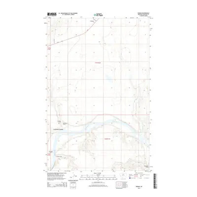
2014 Map of Verona
USGS Topo · Published 2014About this map
The Missouri River winds through the southern half of this Chouteau County landscape, creating a distinct topographical break from the northern plains. Along its banks, the Coal Banks Landing and the small settlement of Virgelle mark historic points of access to the water, connected by the Coal Banks Bridge. The terrain is defined by deep incisions from the prairie down to the riverbed, most notably through Coal Banks Coulee, Jackson Coulee, and Rattlesnake Coulee. In the north, the community of Verona sits near the junction of Us-87 and Verona Rd, serving as a focal point for the region's agricultural transport network. The map reveals the intricate drainage patterns of the upper Missouri, including the meandering path of Little Sandy Cr as it approaches the main river valley.
Find a feature on this map
16 named features on this map. Tap any name to fly to it.
Don’t see what you’re looking for? This feature index may not catch every label — zoom into the map to look around manually.
Map Details
Editions of this 2014 Verona Map
This is the sole edition of this map. No revisions or reprints were ever made.
Other maps of this area

1890 · Fort Benton
USGS Topo · 1:250,000

1892 · Fort Benton
USGS Topo · 1:250,000

1897 · Fort Benton
USGS Topo · 1:250,000

1906 · Lonesome
USGS Topo · 1:62,500

1919 · Big Sandy
USGS Topo · 1:125,000

1953 · Boggs Island
USGS Topo · 1:24,000

1953 · Verona
USGS Topo · 1:24,000

1953 · Big Bend School
USGS Topo · 1:24,000

1953 · Lonetree Coulee
USGS Topo · 1:24,000

1953 · Pilot Rock
USGS Topo · 1:24,000