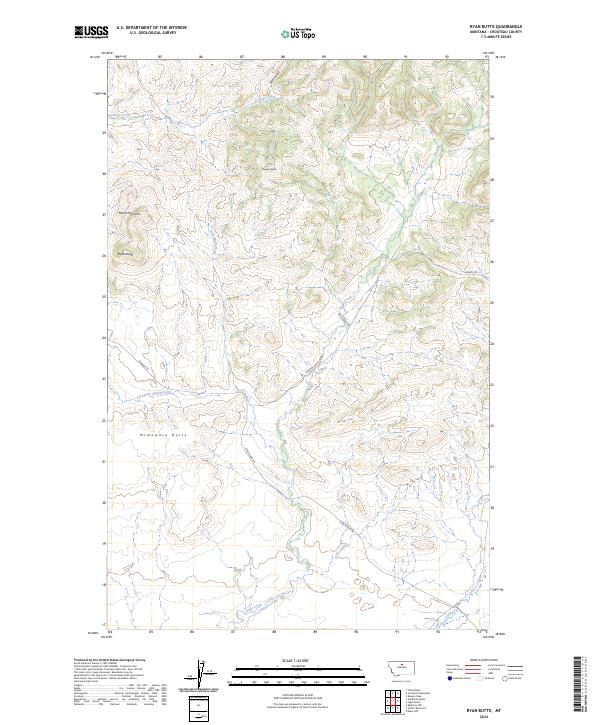
2024 Map of Ryan Butte
USGS Topo · Published 2024About this map
Mount Hancock and Ryan Butte dominate this portion of Chouteau County, where the high plains of Montana meet the breaks of the Missouri River drainage. The landscape is defined by its dramatic verticality, with prominent formations like McNamara Butte and Flying A Butte standing as landmarks for travelers moving along Warrick Rd. This terrain is deeply incised by a drainage network including Godfrey Creek, Salt Coulee, and the winding Eagle Creek.
Find a feature on this map
17 named features on this map. Tap any name to fly to it.
Don’t see what you’re looking for? This feature index may not catch every label — zoom into the map to look around manually.
Map Details
Editions of this 2024 Ryan Butte Map
This is the sole edition of this map. No revisions or reprints were ever made.
Other maps of this area

1953 · Havre
USGS Topo · 1:250,000

1954 · Lewistown
USGS Topo · 1:250,000

1957 · Havre
USGS Topo · 1:250,000

1958 · Havre
USGS Topo · 1:250,000

1959 · Lewistown
USGS Topo · 1:250,000

1959 · Warrick
USGS Topo · 1:62,500

1959 · Centennial Mountain
USGS Topo · 1:62,500
1984 · Bowery Peak
USGS Topo · 1:24,000
1984 · Centennial Mountain
USGS Topo · 1:24,000
1984 · Seifort Reservoir
USGS Topo · 1:24,000