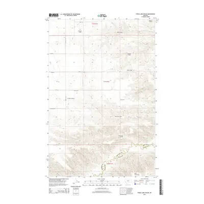
2014 Map of Steele Lake Coulee
USGS Topo · Published 2014About this map
Steele Lake Coulee and its neighboring drainages define the high-plains geography at the border of Fergus and Chouteau counties. The landscape is characterized by a series of significant coulees, including Wilson Coulee, Fahlgren Coulee, and Engellant Coulee, which cut through the tableland towards the Arrow Creek valley. To the southeast, the terrain transitions into the flat expanse of Arrow Creek Bench. The pattern of early 21st-century land use is evident in the rectilinear grid of local roads, such as Range Rd and Red Barn Rd, which provide access to the remote sections of townships T20N, T21N, and T22N. This survey documents the complex system of ephemeral watercourses and named family-landmark coulees like Woodcock Coulee and Cut Bank Coulee that have long influenced ranching and navigation in this section of central Montana.
Find a feature on this map
22 named features on this map. Tap any name to fly to it.
Don’t see what you’re looking for? This feature index may not catch every label — zoom into the map to look around manually.
Map Details
Editions of this 2014 Steele Lake Coulee Map
This is the sole edition of this map. No revisions or reprints were ever made.
Other maps of this area

1890 · Fort Benton
USGS Topo · 1:250,000

1892 · Fort Benton
USGS Topo · 1:250,000

1897 · Fort Benton
USGS Topo · 1:250,000

1953 · Starve Out Flat
USGS Topo · 1:24,000

1953 · Last Chance Bench
USGS Topo · 1:24,000

1954 · Great Falls
USGS Topo · 1:250,000

1954 · Lewistown
USGS Topo · 1:250,000

1957 · Great Falls
USGS Topo · 1:250,000

1959 · Lewistown
USGS Topo · 1:250,000

1964 · Spring Coulee
USGS Topo · 1:24,000