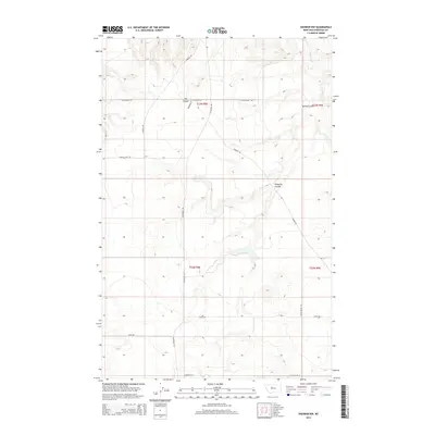
2014 Map of Shonkin NW
USGS Topo · Published 2014About this map
Shonkin Cr winds through a landscape defined by deep erosional features and high benchlands in this Chouteau County survey. The terrain is dominated by significant coulees and canyons, notably The Canyon and Spring Coulee, which cut into the high plains. A network of rural section-line roads and named local routes, such as N Bench Rd and Bird Coulee Rd, provide access to this ranching and agricultural country.
Find a feature on this map
21 named features on this map. Tap any name to fly to it.
Don’t see what you’re looking for? This feature index may not catch every label — zoom into the map to look around manually.
Map Details
Editions of this 2014 Shonkin NW Map
This is the sole edition of this map. No revisions or reprints were ever made.
Other maps of this area

1890 · Fort Benton
USGS Topo · 1:250,000

1892 · Fort Benton
USGS Topo · 1:250,000

1897 · Fort Benton
USGS Topo · 1:250,000

1953 · Tunis
USGS Topo · 1:24,000

1953 · O'Hanlon Coulee
USGS Topo · 1:24,000

1954 · Great Falls
USGS Topo · 1:250,000

1954 · Rice Reservoir
USGS Topo · 1:24,000

1954 · Fort Benton
USGS Topo · 1:24,000

1956 · Highwood
USGS Topo · 1:62,500

1957 · Great Falls
USGS Topo · 1:250,000